Villaines-sous-Lucé geodata
Villaines-sous-Lucé (Pays de la Loire) is a populated place; located in France in Europe/Paris (GMT+2) time zone. With population of 597 people, there are 13370 cities with bigger population in this country. Compared to other cities in France, 56.9% of cities are located further ↓South; 73.6% of cities are located further →East and 62.4% of cities have higher elevation than Villaines-sous-Lucé. Note1
Administrative division(s):
- Level 1: Pays de la Loire
- Level 2: Sarthe
- Level 3: Arrondissement de La Flèche
- Level 4: Villaines-sous-Lucé


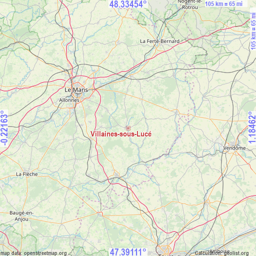
Villaines-sous-Lucé GPS coordinates[2]
47° 51' 53.892" North, 0° 28' 53.364" East
| Map corner | latitude | longitude |
|---|---|---|
| Upper-left | 48.33454°, | -0.22163° |
| Center: | 47.86497°, | 0.48149° |
| Lower-right: | 47.39111°, | 1.18462° |
| Map W x H: | 104.9×104.9 km | = 65.2×65.2mi |
| max Lat: | 51.07786° ⇑43.1% North |
| Villaines-sous-Lucé: | 47.86497° |
| min Lat: | ⇓56.9% South 41.3874° |
| min Long | Villaines-sous- | max Long |
| -5.08615° | 0.48149° | 9.52242° |
| W 26.4%⇐ | ⇒73.6% E |
Elevation
Elevation of Villaines-sous-Lucé is 96 m = 315 ft, and this is 97.7 m = 321 ft below average elevation for this country.
| Max E: |
2333 m = 7654 ft | 62.4% |
| Avg. | 193.7 m = 635 ft | |
| Villaines-sous-Lucé | 96 m = 315 ft | |
Min E: |
-1 m = -3 ft | 37.6% |
See also: France elevation on elevation.city.
Geographical zone
Villaines-sous-Lucé is located in North temperate zone (between Tropic of Cancer and the Arctic Circle). Distance of this North polar circle is 2079.1 km =1291.9 mi to North.| Distance of | km | miles | from Villaines-sous-Lucé |
|---|---|---|---|
| North Pole | 4685 | 2911.1 | to North |
| Arctic Circle | 2079.1 | 1291.9 | to North |
| Tropic Cancer | 2716.2 | 1687.8 | to South |
| Equator | 5322.1 | 3307 | to South |


Nearby cities:
15 places around Villaines-sous-Lucé: (largest is in red/bold)
• Bouloire
13.1 km =8.1 mi,  22°
22°
• Brette-les-Pins
11.9 km =7.4 mi,  295°
295°
• Chahaignes
13.9 km =8.6 mi,  170°
170°
• Challes
8.8 km =5.5 mi,  325°
325°
• Courdemanche
8.2 km =5.1 mi,  132°
132°
• Flée
14.8 km =9.2 mi,  188°
188°
• Jupilles
9.7 km =6 mi,  211°
211°
• Le Breil-sur-Mérize
15.9 km =9.9 mi,  359°
359°
• Le Grand-Lucé
0.9 km =0.6 mi,  278°
278°
• Lhomme
14.7 km =9.1 mi,  156°
156°
• Marigné-Laillé
11.8 km =7.3 mi,  243°
243°
• Saint-Mars-d’Outillé
11.2 km =7 mi,  273°
273°
• Saint-Vincent-du-Lorouër
4.5 km =2.8 mi, 171°
• Teloché
15.9 km =9.9 mi, 279°
• Volnay
7.6 km =4.7 mi,  352°
352°
Sources, notices
• [Note1] Compared only with cities in France existing in our database
• [Src1] Map data: © OpenStreetMap contributors (CC-BY-SA)
• [Src2] Other city data from geonames.org with taken over terms of usage.
• [Src3] Geographical zone / Annual Mean Temperature by Robert A. Rohde @ Wikipedia
