Vercel-Villedieu-le-Camp geodata
Vercel-Villedieu-le-Camp (Bourgogne-Franche-Comté) is a populated place; located in France in Europe/Paris (GMT+2) time zone. With population of 1,321 people, there are 6934 cities with bigger population in this country. Compared to other cities in France, 53.3% of cities are located further ↑North; 91.1% of cities are located further ←West and 96.2% of cities have lower elevation than Vercel-Villedieu-le-Camp. Note1
Administrative division(s):
- Level 1: Bourgogne-Franche-Comté
- Level 2: Doubs
- Level 3: Arrondissement de Pontarlier
- Level 4: Vercel-Villedieu-le-Camp
Current local time in Vercel-Villedieu-le-Camp:
03:33 PM, SaturdayDifference from your time zone: hours


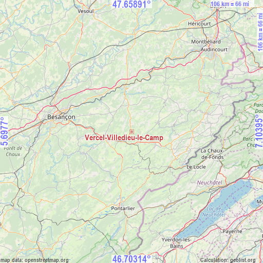
Vercel-Villedieu-le-Camp GPS coordinates[2]
47° 10' 59.448" North, 6° 24' 2.952" East
| Map corner | latitude | longitude |
|---|---|---|
| Upper-left | 47.65891°, | 5.6977° |
| Center: | 47.18318°, | 6.40082° |
| Lower-right: | 46.70314°, | 7.10395° |
| Map W x H: | 106.3×106.3 km | = 66.1×66.1mi |
| max Lat: | 51.07786° ⇑53.3% North |
| Vercel-Villedieu-le-Camp: | 47.18318° |
| min Lat: | ⇓46.7% South 41.3874° |
| min Long | Vercel-Villedie | max Long |
| -5.08615° | 6.40082° | 9.52242° |
| W 91.1%⇐ | ⇒8.9% E |
Elevation
Elevation of Vercel-Villedieu-le-Camp is 658 m = 2159 ft, and this is 464.3 m = 1523 ft above average elevation for this country.
| Max E: |
2333 m = 7654 ft | 3.8% |
| Vercel-Villedieu-le-Camp | 658 m 2159 ft | |
| Avg. | 193.7 m = 635 ft | |
Min E: |
-1 m = -3 ft | 96.2% |
See also: France elevation on elevation.city.
Geographical zone
Vercel-Villedieu-le-Camp is located in North temperate zone (between Tropic of Cancer and the Arctic Circle). Distance of this North polar circle is 2154.9 km =1339 mi to North.| Distance of | km | miles | from Vercel-Villedieu-le-Camp |
|---|---|---|---|
| North Pole | 4760.8 | 2958.2 | to North |
| Arctic Circle | 2154.9 | 1339 | to North |
| Tropic Cancer | 2640.4 | 1640.7 | to South |
| Equator | 5246.3 | 3259.9 | to South |


Nearby cities:
15 places around Vercel-Villedieu-le-Camp: (largest is in red/bold)
• Arc-sous-Cicon
14.8 km =9.2 mi,  186°
186°
• Avoudrey
5.7 km =3.5 mi,  154°
154°
• Bouclans
14.1 km =8.8 mi,  299°
299°
• Flangebouche
7.2 km =4.5 mi,  132°
132°
• Gilley
16.3 km =10.1 mi,  157°
157°
• Guyans-Vennes
13.2 km =8.2 mi,  102°
102°
• Les Combes
17.2 km =10.7 mi,  138°
138°
• Mamirolle
18.3 km =11.4 mi,  275°
275°
• Naisey-les-Granges
12 km =7.5 mi,  288°
288°
• Nancray
17.9 km =11.1 mi, 292°
• Orchamps-Vennes
11.1 km =6.9 mi,  122°
122°
• Pierrefontaine-les-Varans
11.2 km =7 mi,  70°
70°
• Sancey-le-Grand
18.5 km =11.5 mi,  47°
47°
• Valdahon
5.3 km =3.3 mi,  226°
226°
• Étalans
10.3 km =6.4 mi,  249°
249°
Sources, notices
• [Note1] Compared only with cities in France existing in our database
• [Src1] Map data: © OpenStreetMap contributors (CC-BY-SA)
• [Src2] Other city data from geonames.org with taken over terms of usage.
• [Src3] Geographical zone / Annual Mean Temperature by Robert A. Rohde @ Wikipedia
