Étalans geodata
Étalans (Bourgogne-Franche-Comté) is a populated place; located in France in Europe/Paris (GMT+2) time zone. With population of 1,030 people, there are 8614 cities with bigger population in this country. Compared to other cities in France, 53.6% of cities are located further ↑North; 89.9% of cities are located further ←West and 95.2% of cities have lower elevation than Étalans. Note1
Administrative division(s):
- Level 1: Bourgogne-Franche-Comté
- Level 2: Doubs
- Level 3: Arrondissement de Pontarlier
- Level 4: Étalans


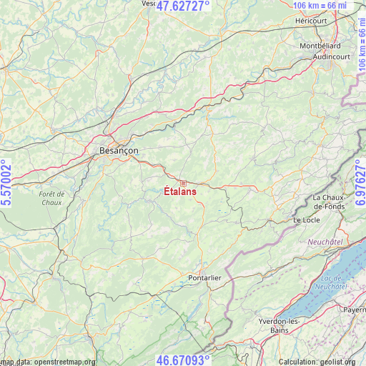
Étalans GPS coordinates[2]
47° 9' 4.5" North, 6° 16' 23.34" East
| Map corner | latitude | longitude |
|---|---|---|
| Upper-left | 47.62727°, | 5.57002° |
| Center: | 47.15125°, | 6.27315° |
| Lower-right: | 46.67093°, | 6.97627° |
| Map W x H: | 106.3×106.3 km | = 66.1×66.1mi |
| max Lat: | 51.07786° ⇑53.6% North |
| Étalans: | 47.15125° |
| min Lat: | ⇓46.4% South 41.3874° |
| min Long | Étalans | max Long |
| -5.08615° | 6.27315° | 9.52242° |
| W 89.9%⇐ | ⇒10.1% E |
Elevation
Elevation of Étalans is 596 m = 1955 ft, and this is 402.3 m = 1320 ft above average elevation for this country.
| Max E: |
2333 m = 7654 ft | 4.8% |
| Étalans | 596 m 1955 ft | |
| Avg. | 193.7 m = 635 ft | |
Min E: |
-1 m = -3 ft | 95.2% |
See also: France elevation on elevation.city.
Geographical zone
Étalans is located in North temperate zone (between Tropic of Cancer and the Arctic Circle). Distance of this North polar circle is 2158.4 km =1341.2 mi to North.| Distance of | km | miles | from Étalans |
|---|---|---|---|
| North Pole | 4764.3 | 2960.4 | to North |
| Arctic Circle | 2158.4 | 1341.2 | to North |
| Tropic Cancer | 2636.8 | 1638.4 | to South |
| Equator | 5242.7 | 3257.7 | to South |


Nearby cities:
15 places around Étalans: (largest is in red/bold)
• Arc-sous-Cicon
13.8 km =8.6 mi,  144°
144°
• Avoudrey
12.2 km =7.6 mi,  97°
97°
• Bouclans
10.8 km =6.7 mi,  345°
345°
• Deluz
16.8 km =10.4 mi,  341°
341°
• Flangebouche
15 km =9.3 mi,  94°
94°
• Gennes
16.1 km =10 mi,  312°
312°
• Mamirolle
10.1 km =6.3 mi,  301°
301°
• Naisey-les-Granges
7.5 km =4.7 mi, 346°
• Nancray
12.5 km =7.8 mi,  326°
326°
• Ornans
11 km =6.8 mi,  243°
243°
• Saône
14.3 km =8.9 mi, 304°
• Tarcenay
12.2 km =7.6 mi,  273°
273°
• Valdahon
5.8 km =3.6 mi, 91°
• Vercel-Villedieu-le-Camp
10.3 km =6.4 mi,  69°
69°
• Vuillafans
10.6 km =6.6 mi,  204°
204°
Sources, notices
• [Note1] Compared only with cities in France existing in our database
• [Src1] Map data: © OpenStreetMap contributors (CC-BY-SA)
• [Src2] Other city data from geonames.org with taken over terms of usage.
• [Src3] Geographical zone / Annual Mean Temperature by Robert A. Rohde @ Wikipedia
