Veauche geodata
Veauche (Auvergne-Rhône-Alpes) is a populated place; located in France in Europe/Paris (GMT+2) time zone. With population of 8,189 people, there are 1181 cities with bigger population in this country. Compared to other cities in France, 73.2% of cities are located further ↑North; 70.5% of cities are located further ←West and 88.2% of cities have lower elevation than Veauche. Note1
Administrative division(s):
- Level 1: Auvergne-Rhône-Alpes
- Level 2: Département de la Loire
- Level 3: Arrondissement de Montbrison
- Level 4: Veauche


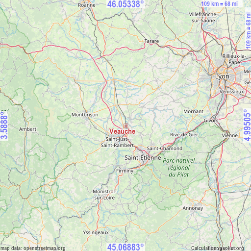
Veauche GPS coordinates[2]
45° 33' 47.736" North, 4° 17' 30.912" East
| Map corner | latitude | longitude |
|---|---|---|
| Upper-left | 46.05338°, | 3.5888° |
| Center: | 45.56326°, | 4.29192° |
| Lower-right: | 45.06883°, | 4.99505° |
| Map W x H: | 109.5×109.5 km | = 68×68mi |
| max Lat: | 51.07786° ⇑73.2% North |
| Veauche: | 45.56326° |
| min Lat: | ⇓26.8% South 41.3874° |
| min Long | Veauche | max Long |
| -5.08615° | 4.29192° | 9.52242° |
| W 70.5%⇐ | ⇒29.5% E |
Elevation
Elevation of Veauche is 391 m = 1283 ft, and this is 197.3 m = 647 ft above average elevation for this country.
| Max E: |
2333 m = 7654 ft | 11.8% |
| Veauche | 391 m 1283 ft | |
| Avg. | 193.7 m = 635 ft | |
Min E: |
-1 m = -3 ft | 88.2% |
See also: France elevation on elevation.city.
Geographical zone
Veauche is located in North temperate zone (between Tropic of Cancer and the Arctic Circle). Distance of this North polar circle is 2335 km =1450.9 mi to North.| Distance of | km | miles | from Veauche |
|---|---|---|---|
| North Pole | 4940.9 | 3070.1 | to North |
| Arctic Circle | 2335 | 1450.9 | to North |
| Tropic Cancer | 2460.2 | 1528.7 | to South |
| Equator | 5066.2 | 3148 | to South |


Nearby cities:
15 places around Veauche: (largest is in red/bold)
• Andrézieux-Bouthéon
4.8 km =3 mi,  210°
210°
• Aveizieux
6.1 km =3.8 mi,  88°
88°
• Bonson
7.6 km =4.7 mi,  233°
233°
• Chambœuf
2.9 km =1.8 mi,  40°
40°
• Craintilleux
5.4 km =3.4 mi,  293°
293°
• Cuzieu
5.6 km =3.5 mi,  331°
331°
• La Fouillouse
6.8 km =4.2 mi,  164°
164°
• Saint-Bonnet-les-Oules
3 km =1.9 mi,  120°
120°
• Saint-Cyprien
5.5 km =3.4 mi, 234°
• Saint-Galmier
4.1 km =2.5 mi,  20°
20°
• Saint-Héand
7.3 km =4.5 mi, 122°
• Saint-Just-Saint-Rambert
8.1 km =5 mi, 209°
• Saint-Médard-en-Forez
6.8 km =4.2 mi,  52°
52°
• Sury-le-Comtal
8.8 km =5.5 mi,  250°
250°
• Veauchette
2.3 km =1.4 mi,  267°
267°
Sources, notices
• [Note1] Compared only with cities in France existing in our database
• [Src1] Map data: © OpenStreetMap contributors (CC-BY-SA)
• [Src2] Other city data from geonames.org with taken over terms of usage.
• [Src3] Geographical zone / Annual Mean Temperature by Robert A. Rohde @ Wikipedia
