Saint-Héand geodata
Saint-Héand (Auvergne-Rhône-Alpes) is a populated place; located in France in Europe/Paris (GMT+2) time zone. With population of 3,781 people, there are 2593 cities with bigger population in this country. Compared to other cities in France, 73.8% of cities are located further ↑North; 71.2% of cities are located further ←West and 96.9% of cities have lower elevation than Saint-Héand. Note1
Administrative division(s):
- Level 1: Auvergne-Rhône-Alpes
- Level 2: Département de la Loire
- Level 3: Arrondissement de Saint-Étienne
- Level 4: Saint-Héand


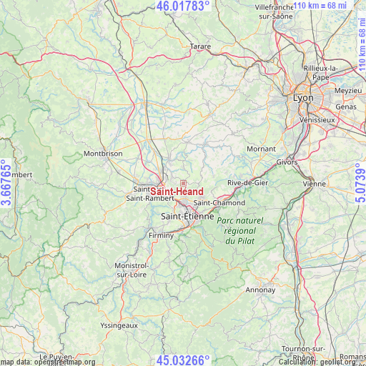
Saint-Héand GPS coordinates[2]
45° 31' 38.64" North, 4° 22' 14.772" East
| Map corner | latitude | longitude |
|---|---|---|
| Upper-left | 46.01783°, | 3.66765° |
| Center: | 45.5274°, | 4.37077° |
| Lower-right: | 45.03266°, | 5.0739° |
| Map W x H: | 109.5×109.5 km | = 68×68mi |
| max Lat: | 51.07786° ⇑73.8% North |
| Saint-Héand: | 45.5274° |
| min Lat: | ⇓26.2% South 41.3874° |
| min Long | Saint-Héand | max Long |
| -5.08615° | 4.37077° | 9.52242° |
| W 71.2%⇐ | ⇒28.8% E |
Elevation
Elevation of Saint-Héand is 719 m = 2359 ft, and this is 525.3 m = 1723 ft above average elevation for this country.
| Max E: |
2333 m = 7654 ft | 3.1% |
| Saint-Héand | 719 m 2359 ft | |
| Avg. | 193.7 m = 635 ft | |
Min E: |
-1 m = -3 ft | 96.9% |
See also: France elevation on elevation.city.
Geographical zone
Saint-Héand is located in North temperate zone (between Tropic of Cancer and the Arctic Circle). Distance of this North polar circle is 2339 km =1453.4 mi to North.| Distance of | km | miles | from Saint-Héand |
|---|---|---|---|
| North Pole | 4944.9 | 3072.6 | to North |
| Arctic Circle | 2339 | 1453.4 | to North |
| Tropic Cancer | 2456.3 | 1526.3 | to South |
| Equator | 5062.2 | 3145.5 | to South |


Nearby cities:
15 places around Saint-Héand: (largest is in red/bold)
• Aveizieux
4.2 km =2.6 mi,  359°
359°
• Chambœuf
7.5 km =4.7 mi,  325°
325°
• Chevrières
7.3 km =4.5 mi,  19°
19°
• Fontanès
5.9 km =3.7 mi,  67°
67°
• Grammond
7 km =4.3 mi,  52°
52°
• La Fouillouse
5 km =3.1 mi,  239°
239°
• La Talaudière
7.2 km =4.5 mi,  142°
142°
• La Tour-en-Jarez
5.1 km =3.2 mi,  162°
162°
• L’Étrat
4.6 km =2.9 mi,  175°
175°
• Saint-Bonnet-les-Oules
4.3 km =2.7 mi,  304°
304°
• Saint-Médard-en-Forez
8.1 km =5 mi,  354°
354°
• Saint-Priest-en-Jarez
6 km =3.7 mi, 175°
• Sorbiers
6.8 km =4.2 mi,  126°
126°
• Veauche
7.3 km =4.5 mi, 302°
• Villars
6.7 km =4.2 mi,  190°
190°
Sources, notices
• [Note1] Compared only with cities in France existing in our database
• [Src1] Map data: © OpenStreetMap contributors (CC-BY-SA)
• [Src2] Other city data from geonames.org with taken over terms of usage.
• [Src3] Geographical zone / Annual Mean Temperature by Robert A. Rohde @ Wikipedia
