Urmatt geodata
Urmatt (Grand Est) is a populated place; located in France in Europe/Paris (GMT+2) time zone. With population of 1,436 people, there are 6450 cities with bigger population in this country. Compared to other cities in France, 69% of cities are located further ↓South; 96.7% of cities are located further ←West and 74.3% of cities have lower elevation than Urmatt. Note1
Administrative division(s):
- Level 1: Grand Est
- Level 2: Bas-Rhin
- Level 3: Arrondissement de Molsheim
- Level 4: Urmatt


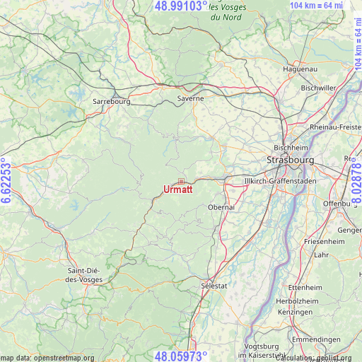
Urmatt GPS coordinates[2]
48° 31' 39.072" North, 7° 19' 32.34" East
| Map corner | latitude | longitude |
|---|---|---|
| Upper-left | 48.99103°, | 6.62253° |
| Center: | 48.52752°, | 7.32565° |
| Lower-right: | 48.05973°, | 8.02878° |
| Map W x H: | 103.6×103.5 km | = 64.4×64.3mi |
| max Lat: | 51.07786° ⇑31% North |
| Urmatt: | 48.52752° |
| min Lat: | ⇓69% South 41.3874° |
| min Long | Urmatt | max Long |
| -5.08615° | 7.32565° | 9.52242° |
| W 96.7%⇐ | ⇒3.3% E |
Elevation
Elevation of Urmatt is 244 m = 801 ft, and this is 50.3 m = 165 ft above average elevation for this country.
| Max E: |
2333 m = 7654 ft | 25.7% |
| Urmatt | 244 m 801 ft | |
| Avg. | 193.7 m = 635 ft | |
Min E: |
-1 m = -3 ft | 74.3% |
See also: France elevation on elevation.city.
Geographical zone
Urmatt is located in North temperate zone (between Tropic of Cancer and the Arctic Circle). Distance of this North polar circle is 2005.4 km =1246.1 mi to North.| Distance of | km | miles | from Urmatt |
|---|---|---|---|
| North Pole | 4611.3 | 2865.3 | to North |
| Arctic Circle | 2005.4 | 1246.1 | to North |
| Tropic Cancer | 2789.8 | 1733.5 | to South |
| Equator | 5395.8 | 3352.8 | to South |


Nearby cities:
15 places around Urmatt: (largest is in red/bold)
• Barembach
9 km =5.6 mi,  232°
232°
• Dinsheim-sur-Bruche
7.7 km =4.8 mi,  77°
77°
• Grendelbruch
3.9 km =2.4 mi,  183°
183°
• Gresswiller
7.9 km =4.9 mi, 83°
• Heiligenberg
5 km =3.1 mi, 76°
• Lutzelhouse
2.9 km =1.8 mi,  256°
256°
• Mollkirch
5 km =3.1 mi,  118°
118°
• Muhlbach-sur-Bruche
2.4 km =1.5 mi,  236°
236°
• Niederhaslach
2.1 km =1.3 mi,  36°
36°
• Oberhaslach
2.6 km =1.6 mi,  10°
10°
• Rosenwiller
8.7 km =5.4 mi,  106°
106°
• Russ
6 km =3.7 mi, 234°
• Schirmeck
9.2 km =5.7 mi, 237°
• Still
6.3 km =3.9 mi,  66°
66°
• Wisches
4.7 km =2.9 mi, 243°
Sources, notices
• [Note1] Compared only with cities in France existing in our database
• [Src1] Map data: © OpenStreetMap contributors (CC-BY-SA)
• [Src2] Other city data from geonames.org with taken over terms of usage.
• [Src3] Geographical zone / Annual Mean Temperature by Robert A. Rohde @ Wikipedia
