Muhlbach-sur-Bruche geodata
Muhlbach-sur-Bruche (Grand Est) is a populated place; located in France in Europe/Paris (GMT+2) time zone. With population of 712 people, there are 11628 cities with bigger population in this country. Compared to other cities in France, 68.7% of cities are located further ↓South; 96.5% of cities are located further ←West and 85.4% of cities have lower elevation than Muhlbach-sur-Bruche. Note1
Administrative division(s):
- Level 1: Grand Est
- Level 2: Bas-Rhin
- Level 3: Arrondissement de Molsheim
- Level 4: Muhlbach-sur-Bruche


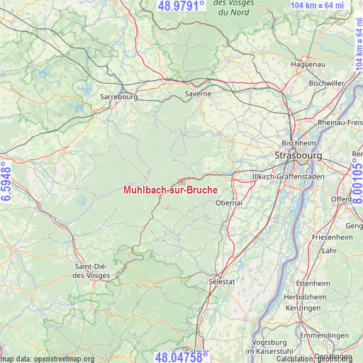
Muhlbach-sur-Bruche GPS coordinates[2]
48° 30' 55.728" North, 7° 17' 52.512" East
| Map corner | latitude | longitude |
|---|---|---|
| Upper-left | 48.9791°, | 6.5948° |
| Center: | 48.51548°, | 7.29792° |
| Lower-right: | 48.04758°, | 8.00105° |
| Map W x H: | 103.6×103.6 km | = 64.4×64.4mi |
| max Lat: | 51.07786° ⇑31.3% North |
| Muhlbach-sur-Bruche: | 48.51548° |
| min Lat: | ⇓68.7% South 41.3874° |
| min Long | Muhlbach-sur-Br | max Long |
| -5.08615° | 7.29792° | 9.52242° |
| W 96.5%⇐ | ⇒3.5% E |
Elevation
Elevation of Muhlbach-sur-Bruche is 351 m = 1152 ft, and this is 157.3 m = 516 ft above average elevation for this country.
| Max E: |
2333 m = 7654 ft | 14.6% |
| Muhlbach-sur-Bruche | 351 m 1152 ft | |
| Avg. | 193.7 m = 635 ft | |
Min E: |
-1 m = -3 ft | 85.4% |
See also: France elevation on elevation.city.
Geographical zone
Muhlbach-sur-Bruche is located in North temperate zone (between Tropic of Cancer and the Arctic Circle). Distance of this North polar circle is 2006.8 km =1247 mi to North.| Distance of | km | miles | from Muhlbach-sur-Bruche |
|---|---|---|---|
| North Pole | 4612.6 | 2866.1 | to North |
| Arctic Circle | 2006.8 | 1247 | to North |
| Tropic Cancer | 2788.5 | 1732.7 | to South |
| Equator | 5394.4 | 3351.9 | to South |


Nearby cities:
15 places around Muhlbach-sur-Bruche: (largest is in red/bold)
• Barembach
6.5 km =4 mi,  230°
230°
• Grendelbruch
3.1 km =1.9 mi,  144°
144°
• Heiligenberg
7.4 km =4.6 mi,  69°
69°
• La Broque
7.6 km =4.7 mi, 231°
• Lutzelhouse
1 km =0.6 mi,  308°
308°
• Mollkirch
6.5 km =4 mi,  99°
99°
• Natzwiller
9.2 km =5.7 mi,  199°
199°
• Niederhaslach
4.5 km =2.8 mi,  47°
47°
• Oberhaslach
4.6 km =2.9 mi,  32°
32°
• Rothau
9.3 km =5.8 mi, 225°
• Russ
3.6 km =2.2 mi, 232°
• Schirmeck
6.8 km =4.2 mi,  237°
237°
• Still
8.7 km =5.4 mi,  64°
64°
• Urmatt
2.4 km =1.5 mi, 56°
• Wisches
2.3 km =1.4 mi,  251°
251°
Sources, notices
• [Note1] Compared only with cities in France existing in our database
• [Src1] Map data: © OpenStreetMap contributors (CC-BY-SA)
• [Src2] Other city data from geonames.org with taken over terms of usage.
• [Src3] Geographical zone / Annual Mean Temperature by Robert A. Rohde @ Wikipedia
