Gresswiller geodata
Gresswiller (Grand Est) is a populated place; located in France in Europe/Paris (GMT+2) time zone. With population of 1,441 people, there are 6426 cities with bigger population in this country. Compared to other cities in France, 69.2% of cities are located further ↓South; 97.5% of cities are located further ←West and 65.2% of cities have lower elevation than Gresswiller. Note1
Administrative division(s):
- Level 1: Grand Est
- Level 2: Bas-Rhin
- Level 3: Arrondissement de Molsheim
- Level 4: Gresswiller


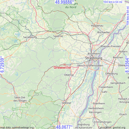
Gresswiller GPS coordinates[2]
48° 32' 7.512" North, 7° 25' 57.036" East
| Map corner | latitude | longitude |
|---|---|---|
| Upper-left | 48.99886°, | 6.72939° |
| Center: | 48.53542°, | 7.43251° |
| Lower-right: | 48.0677°, | 8.13564° |
| Map W x H: | 103.5×103.5 km | = 64.3×64.3mi |
| max Lat: | 51.07786° ⇑30.8% North |
| Gresswiller: | 48.53542° |
| min Lat: | ⇓69.2% South 41.3874° |
| min Long | Gresswiller | max Long |
| -5.08615° | 7.43251° | 9.52242° |
| W 97.5%⇐ | ⇒2.5% E |
Elevation
Elevation of Gresswiller is 195 m = 640 ft, and this is 1.3 m = 4 ft above average elevation for this country.
| Max E: |
2333 m = 7654 ft | 34.8% |
| Gresswiller | 195 m 640 ft | |
| Avg. | 193.7 m = 635 ft | |
Min E: |
-1 m = -3 ft | 65.2% |
See also: France elevation on elevation.city.
Geographical zone
Gresswiller is located in North temperate zone (between Tropic of Cancer and the Arctic Circle). Distance of this North polar circle is 2004.5 km =1245.5 mi to North.| Distance of | km | miles | from Gresswiller |
|---|---|---|---|
| North Pole | 4610.4 | 2864.8 | to North |
| Arctic Circle | 2004.5 | 1245.5 | to North |
| Tropic Cancer | 2790.7 | 1734.1 | to South |
| Equator | 5396.6 | 3353.3 | to South |


Nearby cities:
15 places around Gresswiller: (largest is in red/bold)
• Avolsheim
5.8 km =3.6 mi,  59°
59°
• Bergbieten
4.9 km =3 mi,  21°
21°
• Bœrsch
6.6 km =4.1 mi,  175°
175°
• Dangolsheim
4.7 km =2.9 mi,  30°
30°
• Dinsheim-sur-Bruche
0.9 km =0.6 mi,  334°
334°
• Dorlisheim
4.1 km =2.5 mi,  106°
106°
• Heiligenberg
3 km =1.9 mi,  276°
276°
• Mollkirch
4.7 km =2.9 mi,  226°
226°
• Molsheim
4.4 km =2.7 mi,  82°
82°
• Mutzig
1.8 km =1.1 mi,  74°
74°
• Niederhaslach
6.7 km =4.2 mi, 276°
• Rosenwiller
3.4 km =2.1 mi,  172°
172°
• Rosheim
5.1 km =3.2 mi,  146°
146°
• Soultz-les-Bains
5.7 km =3.5 mi,  44°
44°
• Still
2.6 km =1.6 mi,  307°
307°
Sources, notices
• [Note1] Compared only with cities in France existing in our database
• [Src1] Map data: © OpenStreetMap contributors (CC-BY-SA)
• [Src2] Other city data from geonames.org with taken over terms of usage.
• [Src3] Geographical zone / Annual Mean Temperature by Robert A. Rohde @ Wikipedia
