Trie-Château geodata
Trie-Château (Hauts-de-France) is a populated place; located in France in Europe/Paris (GMT+2) time zone. With population of 1,539 people, there are 6054 cities with bigger population in this country. Compared to other cities in France, 85.8% of cities are located further ↓South; 59.2% of cities are located further →East and 76.2% of cities have higher elevation than Trie-Château. Note1
Administrative division(s):
- Level 1: Hauts-de-France
- Level 2: Département de l'Oise
- Level 3: Arrondissement de Beauvais
- Level 4: Trie-Château


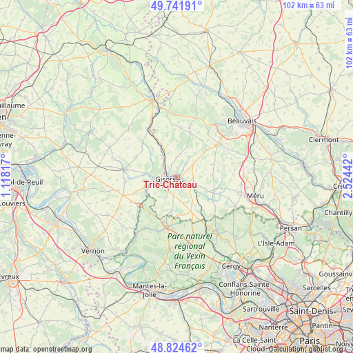
Trie-Château GPS coordinates[2]
49° 17' 7.44" North, 1° 49' 16.644" East
| Map corner | latitude | longitude |
|---|---|---|
| Upper-left | 49.74191°, | 1.11817° |
| Center: | 49.2854°, | 1.82129° |
| Lower-right: | 48.82462°, | 2.52442° |
| Map W x H: | 102×102 km | = 63.4×63.4mi |
| max Lat: | 51.07786° ⇑14.2% North |
| Trie-Château: | 49.2854° |
| min Lat: | ⇓85.8% South 41.3874° |
| min Long | Trie-Château | max Long |
| -5.08615° | 1.82129° | 9.52242° |
| W 40.8%⇐ | ⇒59.2% E |
Elevation
Elevation of Trie-Château is 64 m = 210 ft, and this is 129.7 m = 426 ft below average elevation for this country.
| Max E: |
2333 m = 7654 ft | 76.2% |
| Avg. | 193.7 m = 635 ft | |
| Trie-Château | 64 m = 210 ft | |
Min E: |
-1 m = -3 ft | 23.8% |
See also: France elevation on elevation.city.
Geographical zone
Trie-Château is located in North temperate zone (between Tropic of Cancer and the Arctic Circle). Distance of this North polar circle is 1921.2 km =1193.8 mi to North.| Distance of | km | miles | from Trie-Château |
|---|---|---|---|
| North Pole | 4527 | 2812.9 | to North |
| Arctic Circle | 1921.2 | 1193.8 | to North |
| Tropic Cancer | 2874.1 | 1785.9 | to South |
| Equator | 5480 | 3405.1 | to South |


Nearby cities:
15 places around Trie-Château: (largest is in red/bold)
• Bazincourt-sur-Epte
5 km =3.1 mi,  307°
307°
• Bézu-Saint-Éloi
8.6 km =5.3 mi,  277°
277°
• Chaumont-en-Vexin
5.2 km =3.2 mi,  114°
114°
• Courcelles-lès-Gisors
6.4 km =4 mi,  243°
243°
• Dangu
9.8 km =6.1 mi,  248°
248°
• Delincourt
4 km =2.5 mi,  167°
167°
• Flavacourt
5.5 km =3.4 mi,  359°
359°
• Gisors
3 km =1.9 mi,  262°
262°
• Hébécourt
10.2 km =6.3 mi,  317°
317°
• La Houssoye
11.7 km =7.3 mi,  48°
48°
• Liancourt-Saint-Pierre
8.5 km =5.3 mi,  130°
130°
• Montagny-en-Vexin
10.1 km =6.3 mi,  188°
188°
• Neaufles-Saint-Martin
6.8 km =4.2 mi, 261°
• Sérifontaine
8.6 km =5.3 mi,  333°
333°
• Éragny-sur-Epte
4.7 km =2.9 mi, 314°
Sources, notices
• [Note1] Compared only with cities in France existing in our database
• [Src1] Map data: © OpenStreetMap contributors (CC-BY-SA)
• [Src2] Other city data from geonames.org with taken over terms of usage.
• [Src3] Geographical zone / Annual Mean Temperature by Robert A. Rohde @ Wikipedia
