Trélon geodata
Trélon (Hauts-de-France) is a populated place; located in France in Europe/Paris (GMT+2) time zone. With population of 2,941 people, there are 3314 cities with bigger population in this country. Compared to other cities in France, 93.9% of cities are located further ↓South; 68.9% of cities are located further ←West and 67.8% of cities have lower elevation than Trélon. Note1
Administrative division(s):
- Level 1: Hauts-de-France
- Level 2: Nord
- Level 3: Avesnes-sur-Helpe
- Level 4: Trélon


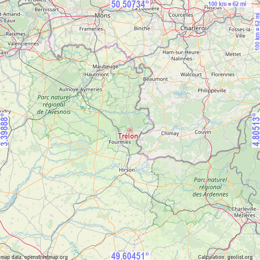
Trélon GPS coordinates[2]
50° 3' 28.98" North, 4° 6' 7.2" East
| Map corner | latitude | longitude |
|---|---|---|
| Upper-left | 50.50734°, | 3.39888° |
| Center: | 50.05805°, | 4.102° |
| Lower-right: | 49.60451°, | 4.80513° |
| Map W x H: | 100.4×100.4 km | = 62.4×62.4mi |
| max Lat: | 51.07786° ⇑6.1% North |
| Trélon: | 50.05805° |
| min Lat: | ⇓93.9% South 41.3874° |
| min Long | Trélon | max Long |
| -5.08615° | 4.102° | 9.52242° |
| W 68.9%⇐ | ⇒31.1% E |
Elevation
Elevation of Trélon is 208 m = 682 ft, and this is 14.3 m = 47 ft above average elevation for this country.
| Max E: |
2333 m = 7654 ft | 32.2% |
| Trélon | 208 m 682 ft | |
| Avg. | 193.7 m = 635 ft | |
Min E: |
-1 m = -3 ft | 67.8% |
See also: France elevation on elevation.city.
Geographical zone
Trélon is located in North temperate zone (between Tropic of Cancer and the Arctic Circle). Distance of this North polar circle is 1835.2 km =1140.3 mi to North.| Distance of | km | miles | from Trélon |
|---|---|---|---|
| North Pole | 4441.1 | 2759.6 | to North |
| Arctic Circle | 1835.2 | 1140.3 | to North |
| Tropic Cancer | 2960 | 1839.3 | to South |
| Equator | 5565.9 | 3458.5 | to South |


Nearby cities:
15 places around Trélon: (largest is in red/bold)
• Anor
7.6 km =4.7 mi,  180°
180°
• Avesnelles
12.9 km =8 mi,  300°
300°
• Avesnes-sur-Helpe
14.5 km =9 mi, 300°
• Clairfontaine
11.5 km =7.1 mi,  223°
223°
• Floyon
15.5 km =9.6 mi,  263°
263°
• Fourmies
6.1 km =3.8 mi, 219°
• Hirson
15.1 km =9.4 mi,  185°
185°
• La Flamengrie
14.4 km =8.9 mi,  244°
244°
• Mondrepuis
11 km =6.8 mi,  197°
197°
• Neuve-Maison
15 km =9.3 mi, 199°
• Sains-du-Nord
7.7 km =4.8 mi, 300°
• Saint-Michel
15.6 km =9.7 mi,  171°
171°
• Sars-Poteries
13.5 km =8.4 mi,  336°
336°
• Solre-le-Château
13 km =8.1 mi,  355°
355°
• Wignehies
8.1 km =5 mi,  234°
234°
Sources, notices
• [Note1] Compared only with cities in France existing in our database
• [Src1] Map data: © OpenStreetMap contributors (CC-BY-SA)
• [Src2] Other city data from geonames.org with taken over terms of usage.
• [Src3] Geographical zone / Annual Mean Temperature by Robert A. Rohde @ Wikipedia
