Toulonjac geodata
Toulonjac (Occitanie) is a populated place; located in France in Europe/Paris (GMT+2) time zone. With population of 680 people, there are 12068 cities with bigger population in this country. Compared to other cities in France, 84.4% of cities are located further ↑North; 57.1% of cities are located further →East and 81.5% of cities have lower elevation than Toulonjac. Note1
Administrative division(s):
- Level 1: Occitanie
- Level 2: Département de l'Aveyron
- Level 3: Arrondissement de Villefranche-de-Rouergue
- Level 4: Toulonjac


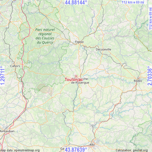
Toulonjac GPS coordinates[2]
44° 22' 51.852" North, 2° 0' 0.864" East
| Map corner | latitude | longitude |
|---|---|---|
| Upper-left | 44.88144°, | 1.29711° |
| Center: | 44.38107°, | 2.00024° |
| Lower-right: | 43.87639°, | 2.70336° |
| Map W x H: | 111.8×111.7 km | = 69.5×69.4mi |
| max Lat: | 51.07786° ⇑84.4% North |
| Toulonjac: | 44.38107° |
| min Lat: | ⇓15.6% South 41.3874° |
| min Long | Toulonjac | max Long |
| -5.08615° | 2.00024° | 9.52242° |
| W 42.9%⇐ | ⇒57.1% E |
Elevation
Elevation of Toulonjac is 305 m = 1001 ft, and this is 111.3 m = 365 ft above average elevation for this country.
| Max E: |
2333 m = 7654 ft | 18.5% |
| Toulonjac | 305 m 1001 ft | |
| Avg. | 193.7 m = 635 ft | |
Min E: |
-1 m = -3 ft | 81.5% |
See also: France elevation on elevation.city.
Geographical zone
Toulonjac is located in North temperate zone (between Tropic of Cancer and the Arctic Circle). Distance of this Northern Tropic circle is 2328.8 km =1447 mi to South.| Distance of | km | miles | from Toulonjac |
|---|---|---|---|
| North Pole | 5072.3 | 3151.8 | to North |
| Arctic Circle | 2466.5 | 1532.6 | to North |
| Tropic Cancer | 2328.8 | 1447 | to South |
| Equator | 4934.7 | 3066.3 | to South |


Nearby cities:
15 places around Toulonjac: (largest is in red/bold)
• Anglars-Saint-Félix
18 km =11.2 mi,  74°
74°
• Cajarc
17.1 km =10.6 mi,  312°
312°
• La Fouillade
17 km =10.6 mi,  169°
169°
• La Rouquette
9 km =5.6 mi,  193°
193°
• Lanuéjouls
14.4 km =8.9 mi, 66°
• Limogne-en-Quercy
17.4 km =10.8 mi,  276°
276°
• Maleville
8.4 km =5.2 mi,  77°
77°
• Martiel
6.2 km =3.9 mi,  265°
265°
• Monteils
12.8 km =8 mi,  180°
180°
• Morlhon-le-Haut
8.1 km =5 mi,  141°
141°
• Sanvensa
10.7 km =6.6 mi,  158°
158°
• Savignac
3.7 km =2.3 mi,  226°
226°
• Vailhourles
11.2 km =7 mi,  221°
221°
• Villefranche-de-Rouergue
4.4 km =2.7 mi, 138°
• Villeneuve
6.4 km =4 mi,  24°
24°
Sources, notices
• [Note1] Compared only with cities in France existing in our database
• [Src1] Map data: © OpenStreetMap contributors (CC-BY-SA)
• [Src2] Other city data from geonames.org with taken over terms of usage.
• [Src3] Geographical zone / Annual Mean Temperature by Robert A. Rohde @ Wikipedia
