Luzay geodata
Luzay (Nouvelle-Aquitaine) is a populated place; located in France in Europe/Paris (GMT+2) time zone. With population of 537 people, there are 14448 cities with bigger population in this country. Compared to other cities in France, 56% of cities are located further ↑North; 79.6% of cities are located further →East and 64.4% of cities have higher elevation than Luzay. Note1
Administrative division(s):
- Level 1: Nouvelle-Aquitaine
- Level 2: Département des Deux-Sèvres
- Level 3: Arrondissement de Bressuire
- Level 4: Luzay


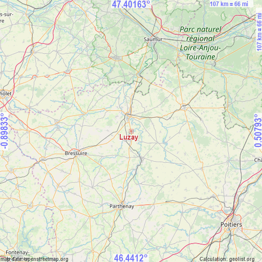
Luzay GPS coordinates[2]
46° 55' 24.852" North, 0° 11' 42.72" West
| Map corner | latitude | longitude |
|---|---|---|
| Upper-left | 47.40163°, | -0.89833° |
| Center: | 46.92357°, | -0.1952° |
| Lower-right: | 46.4412°, | 0.50793° |
| Map W x H: | 106.8×106.8 km | = 66.4×66.4mi |
| max Lat: | 51.07786° ⇑56% North |
| Luzay: | 46.92357° |
| min Lat: | ⇓44% South 41.3874° |
| min Long | Luzay | max Long |
| -5.08615° | -0.1952° | 9.52242° |
| W 20.4%⇐ | ⇒79.6% E |
Elevation
Elevation of Luzay is 91 m = 299 ft, and this is 102.7 m = 337 ft below average elevation for this country.
| Max E: |
2333 m = 7654 ft | 64.4% |
| Avg. | 193.7 m = 635 ft | |
| Luzay | 91 m = 299 ft | |
Min E: |
-1 m = -3 ft | 35.6% |
See also: France elevation on elevation.city.
Geographical zone
Luzay is located in North temperate zone (between Tropic of Cancer and the Arctic Circle). Distance of this North polar circle is 2183.8 km =1356.9 mi to North.| Distance of | km | miles | from Luzay |
|---|---|---|---|
| North Pole | 4789.7 | 2976.2 | to North |
| Arctic Circle | 2183.8 | 1356.9 | to North |
| Tropic Cancer | 2611.5 | 1622.7 | to South |
| Equator | 5217.4 | 3241.9 | to South |


Nearby cities:
15 places around Luzay: (largest is in red/bold)
• Airvault
11.6 km =7.2 mi,  157°
157°
• Glénay
8.3 km =5.2 mi,  211°
211°
• Louin
13.7 km =8.5 mi,  168°
168°
• Louzy
9.8 km =6.1 mi,  3°
3°
• Mauzé-Thouarsais
8.6 km =5.3 mi,  312°
312°
• Missé
2.8 km =1.7 mi, 4°
• Oiron
9.1 km =5.7 mi,  70°
70°
• Saint-Jean-de-Thouars
4.7 km =2.9 mi,  344°
344°
• Saint-Jouin-de-Marnes
11.7 km =7.3 mi,  114°
114°
• Saint-Léger-de-Montbrun
9.7 km =6 mi,  28°
28°
• Saint-Varent
4.7 km =2.9 mi,  216°
216°
• Sainte-Radegonde
7.8 km =4.8 mi,  327°
327°
• Sainte-Verge
9.4 km =5.8 mi,  352°
352°
• Taizé
6.1 km =3.8 mi,  88°
88°
• Thouars
6.6 km =4.1 mi, 348°
Sources, notices
• [Note1] Compared only with cities in France existing in our database
• [Src1] Map data: © OpenStreetMap contributors (CC-BY-SA)
• [Src2] Other city data from geonames.org with taken over terms of usage.
• [Src3] Geographical zone / Annual Mean Temperature by Robert A. Rohde @ Wikipedia
