Terminiers geodata
Terminiers (Centre) is a populated place; located in France in Europe/Paris (GMT+2) time zone. With population of 953 people, there are 9182 cities with bigger population in this country. Compared to other cities in France, 60.8% of cities are located further ↓South; 60.1% of cities are located further →East and 50.1% of cities have lower elevation than Terminiers. Note1
Administrative division(s):
- Level 1: Centre
- Level 2: Département d'Eure-et-Loir
- Level 3: Arrondissement de Châteaudun
- Level 4: Terminiers


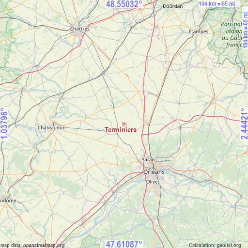
Terminiers GPS coordinates[2]
48° 4' 57.864" North, 1° 44' 27.888" East
| Map corner | latitude | longitude |
|---|---|---|
| Upper-left | 48.55032°, | 1.03796° |
| Center: | 48.08274°, | 1.74108° |
| Lower-right: | 47.61087°, | 2.44421° |
| Map W x H: | 104.5×104.5 km | = 64.9×64.9mi |
| max Lat: | 51.07786° ⇑39.2% North |
| Terminiers: | 48.08274° |
| min Lat: | ⇓60.8% South 41.3874° |
| min Long | Terminiers | max Long |
| -5.08615° | 1.74108° | 9.52242° |
| W 39.9%⇐ | ⇒60.1% E |
Elevation
Elevation of Terminiers is 132 m = 433 ft, and this is 61.7 m = 202 ft below average elevation for this country.
| Max E: |
2333 m = 7654 ft | 49.9% |
| Avg. | 193.7 m = 635 ft | |
| Terminiers | 132 m = 433 ft | |
Min E: |
-1 m = -3 ft | 50.1% |
See also: France elevation on elevation.city.
Geographical zone
Terminiers is located in North temperate zone (between Tropic of Cancer and the Arctic Circle). Distance of this North polar circle is 2054.9 km =1276.9 mi to North.| Distance of | km | miles | from Terminiers |
|---|---|---|---|
| North Pole | 4660.8 | 2896.1 | to North |
| Arctic Circle | 2054.9 | 1276.9 | to North |
| Tropic Cancer | 2740.4 | 1702.8 | to South |
| Equator | 5346.3 | 3322 | to South |


Nearby cities:
15 places around Terminiers: (largest is in red/bold)
• Artenay
10.4 km =6.5 mi,  90°
90°
• Baigneaux
7.9 km =4.9 mi,  44°
44°
• Boulay-les-Barres
11.4 km =7.1 mi,  164°
164°
• Bricy
9.8 km =6.1 mi, 163°
• Cercottes
15 km =9.3 mi,  135°
135°
• Chevilly
11.5 km =7.1 mi,  120°
120°
• Gidy
13 km =8.1 mi,  146°
146°
• Janville
16.9 km =10.5 mi, 37°
• Orgères-en-Beauce
8.3 km =5.2 mi,  328°
328°
• Ormes
16.7 km =10.4 mi, 159°
• Patay
5.1 km =3.2 mi,  221°
221°
• Saint-Péravy-la-Colombe
9.8 km =6.1 mi,  197°
197°
• Sancheville
17.2 km =10.7 mi,  315°
315°
• Sougy
4.7 km =2.9 mi,  133°
133°
• Épieds-en-Beauce
17.3 km =10.7 mi,  212°
212°
Sources, notices
• [Note1] Compared only with cities in France existing in our database
• [Src1] Map data: © OpenStreetMap contributors (CC-BY-SA)
• [Src2] Other city data from geonames.org with taken over terms of usage.
• [Src3] Geographical zone / Annual Mean Temperature by Robert A. Rohde @ Wikipedia
