Sougy geodata
Sougy (Centre) is a populated place; located in France in Europe/Paris (GMT+2) time zone. With population of 850 people, there are 10081 cities with bigger population in this country. Compared to other cities in France, 60.3% of cities are located further ↓South; 59.5% of cities are located further →East and 50.5% of cities have higher elevation than Sougy. Note1
Administrative division(s):
- Level 1: Centre
- Level 2: Loiret
- Level 3: Arrondissement d’Orléans
- Level 4: Sougy


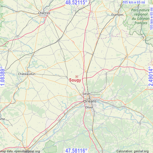
Sougy GPS coordinates[2]
48° 3' 11.88" North, 1° 47' 13.236" East
| Map corner | latitude | longitude |
|---|---|---|
| Upper-left | 48.52115°, | 1.08389° |
| Center: | 48.0533°, | 1.78701° |
| Lower-right: | 47.58116°, | 2.49014° |
| Map W x H: | 104.5×104.5 km | = 64.9×64.9mi |
| max Lat: | 51.07786° ⇑39.7% North |
| Sougy: | 48.0533° |
| min Lat: | ⇓60.3% South 41.3874° |
| min Long | Sougy | max Long |
| -5.08615° | 1.78701° | 9.52242° |
| W 40.5%⇐ | ⇒59.5% E |
Elevation
Elevation of Sougy is 130 m = 427 ft, and this is 63.7 m = 209 ft below average elevation for this country.
| Max E: |
2333 m = 7654 ft | 50.5% |
| Avg. | 193.7 m = 635 ft | |
| Sougy | 130 m = 427 ft | |
Min E: |
-1 m = -3 ft | 49.5% |
See also: France elevation on elevation.city.
Geographical zone
Sougy is located in North temperate zone (between Tropic of Cancer and the Arctic Circle). Distance of this North polar circle is 2058.1 km =1278.8 mi to North.| Distance of | km | miles | from Sougy |
|---|---|---|---|
| North Pole | 4664 | 2898.1 | to North |
| Arctic Circle | 2058.1 | 1278.8 | to North |
| Tropic Cancer | 2737.1 | 1700.8 | to South |
| Equator | 5343 | 3320 | to South |


Nearby cities:
15 places around Sougy: (largest is in red/bold)
• Artenay
7.7 km =4.8 mi,  65°
65°
• Baigneaux
9.2 km =5.7 mi,  13°
13°
• Boulay-les-Barres
7.7 km =4.8 mi,  182°
182°
• Bricy
6.1 km =3.8 mi,  185°
185°
• Cercottes
10.3 km =6.4 mi,  136°
136°
• Chevilly
7 km =4.3 mi,  112°
112°
• Gidy
8.5 km =5.3 mi,  153°
153°
• Ingré
15.1 km =9.4 mi,  168°
168°
• Orgères-en-Beauce
12.9 km =8 mi,  323°
323°
• Ormes
12.6 km =7.8 mi, 169°
• Patay
6.9 km =4.3 mi,  265°
265°
• Saint-Lyé-la-Forêt
14.6 km =9.1 mi,  95°
95°
• Saint-Péravy-la-Colombe
8.8 km =5.5 mi,  226°
226°
• Saran
13.2 km =8.2 mi, 150°
• Terminiers
4.7 km =2.9 mi,  313°
313°
Sources, notices
• [Note1] Compared only with cities in France existing in our database
• [Src1] Map data: © OpenStreetMap contributors (CC-BY-SA)
• [Src2] Other city data from geonames.org with taken over terms of usage.
• [Src3] Geographical zone / Annual Mean Temperature by Robert A. Rohde @ Wikipedia
