Tavaux-et-Pontséricourt geodata
Tavaux-et-Pontséricourt (Hauts-de-France) is a populated place; located in France in Europe/Paris (GMT+2) time zone. With population of 562 people, there are 13969 cities with bigger population in this country. Compared to other cities in France, 91.8% of cities are located further ↓South; 67% of cities are located further ←West and 60.4% of cities have higher elevation than Tavaux-et-Pontséricourt. Note1
Administrative division(s):
- Level 1: Hauts-de-France
- Level 2: Département de l'Aisne
- Level 3: Arrondissement de Laon
- Level 4: Tavaux-et-Pontséricourt
Current local time in Tavaux-et-Pontséricourt:
10:42 PM, FridayDifference from your time zone: hours


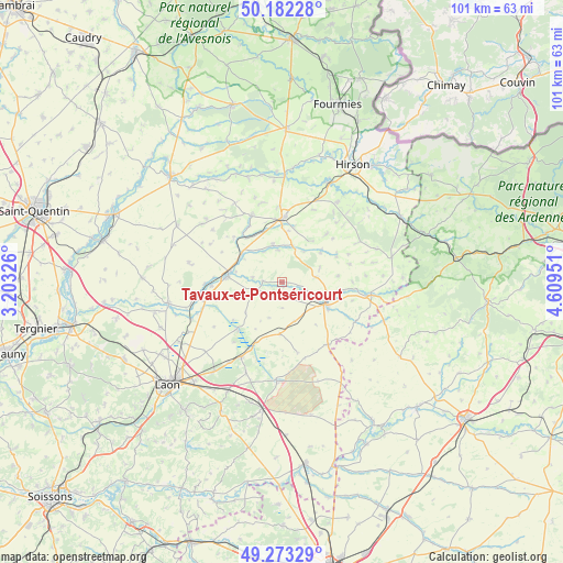
Tavaux-et-Pontséricourt GPS coordinates[2]
49° 43' 47.676" North, 3° 54' 23.004" East
| Map corner | latitude | longitude |
|---|---|---|
| Upper-left | 50.18228°, | 3.20326° |
| Center: | 49.72991°, | 3.90639° |
| Lower-right: | 49.27329°, | 4.60951° |
| Map W x H: | 101.1×101.1 km | = 62.8×62.8mi |
| max Lat: | 51.07786° ⇑8.2% North |
| Tavaux-et-Pontséricourt: | 49.72991° |
| min Lat: | ⇓91.8% South 41.3874° |
| min Long | Tavaux-et-Ponts | max Long |
| -5.08615° | 3.90639° | 9.52242° |
| W 67%⇐ | ⇒33% E |
Elevation
Elevation of Tavaux-et-Pontséricourt is 101 m = 331 ft, and this is 92.7 m = 304 ft below average elevation for this country.
| Max E: |
2333 m = 7654 ft | 60.4% |
| Avg. | 193.7 m = 635 ft | |
| Tavaux-et-Pontséricourt | 101 m = 331 ft | |
Min E: |
-1 m = -3 ft | 39.6% |
See also: France elevation on elevation.city.
Geographical zone
Tavaux-et-Pontséricourt is located in North temperate zone (between Tropic of Cancer and the Arctic Circle). Distance of this North polar circle is 1871.7 km =1163 mi to North.| Distance of | km | miles | from Tavaux-et-Pontséricourt |
|---|---|---|---|
| North Pole | 4477.6 | 2782.3 | to North |
| Arctic Circle | 1871.7 | 1163 | to North |
| Tropic Cancer | 2923.5 | 1816.6 | to South |
| Equator | 5529.4 | 3435.8 | to South |


Nearby cities:
15 places around Tavaux-et-Pontséricourt: (largest is in red/bold)
• Chaourse
7.2 km =4.5 mi,  112°
112°
• Dizy-le-Gros
14 km =8.7 mi,  143°
143°
• Fontaine-lès-Vervins
13.7 km =8.5 mi,  358°
358°
• Gizy
17.2 km =10.7 mi,  213°
213°
• La Bouteille
15.3 km =9.5 mi,  18°
18°
• Landouzy-la-Ville
17.7 km =11 mi,  34°
34°
• Liesse-Notre-Dame
14.7 km =9.1 mi, 211°
• Marle
9.8 km =6.1 mi,  276°
276°
• Montcornet
8.8 km =5.5 mi,  115°
115°
• Plomion
12 km =7.5 mi,  42°
42°
• Rozoy-sur-Serre
16.2 km =10.1 mi,  98°
98°
• Sains-Richaumont
17.5 km =10.9 mi,  306°
306°
• Sissonne
17.7 km =11 mi,  182°
182°
• Vervins
11.7 km =7.3 mi,  1°
1°
• Étréaupont
19.4 km =12.1 mi, 1°
Sources, notices
• [Note1] Compared only with cities in France existing in our database
• [Src1] Map data: © OpenStreetMap contributors (CC-BY-SA)
• [Src2] Other city data from geonames.org with taken over terms of usage.
• [Src3] Geographical zone / Annual Mean Temperature by Robert A. Rohde @ Wikipedia
