Chaourse geodata
Chaourse (Hauts-de-France) is a populated place; located in France in Europe/Paris (GMT+2) time zone. With population of 527 people, there are 14675 cities with bigger population in this country. Compared to other cities in France, 91.6% of cities are located further ↓South; 67.8% of cities are located further ←West and 54.4% of cities have higher elevation than Chaourse. Note1
Administrative division(s):
- Level 1: Hauts-de-France
- Level 2: Département de l'Aisne
- Level 3: Arrondissement de Vervins
- Level 4: Chaourse


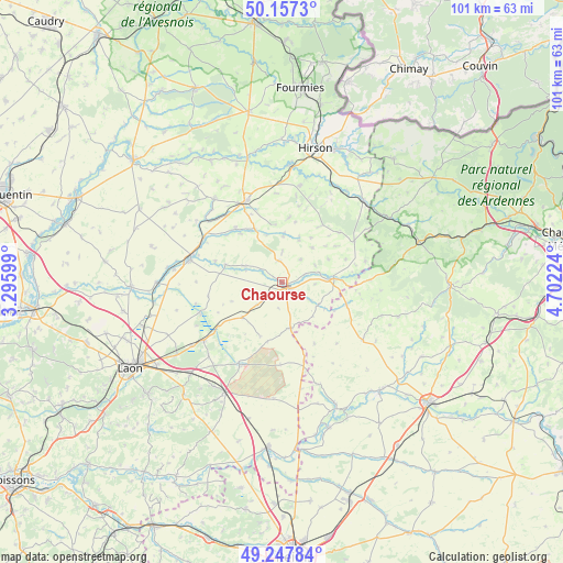
Chaourse GPS coordinates[2]
49° 42' 16.92" North, 3° 59' 56.796" East
| Map corner | latitude | longitude |
|---|---|---|
| Upper-left | 50.1573°, | 3.29599° |
| Center: | 49.7047°, | 3.99911° |
| Lower-right: | 49.24784°, | 4.70224° |
| Map W x H: | 101.1×101.1 km | = 62.8×62.8mi |
| max Lat: | 51.07786° ⇑8.4% North |
| Chaourse: | 49.7047° |
| min Lat: | ⇓91.6% South 41.3874° |
| min Long | Chaourse | max Long |
| -5.08615° | 3.99911° | 9.52242° |
| W 67.8%⇐ | ⇒32.2% E |
Elevation
Elevation of Chaourse is 118 m = 387 ft, and this is 75.7 m = 248 ft below average elevation for this country.
| Max E: |
2333 m = 7654 ft | 54.4% |
| Avg. | 193.7 m = 635 ft | |
| Chaourse | 118 m = 387 ft | |
Min E: |
-1 m = -3 ft | 45.6% |
See also: France elevation on elevation.city.
Geographical zone
Chaourse is located in North temperate zone (between Tropic of Cancer and the Arctic Circle). Distance of this North polar circle is 1874.5 km =1164.8 mi to North.| Distance of | km | miles | from Chaourse |
|---|---|---|---|
| North Pole | 4480.4 | 2784 | to North |
| Arctic Circle | 1874.5 | 1164.8 | to North |
| Tropic Cancer | 2920.7 | 1814.8 | to South |
| Equator | 5526.6 | 3434.1 | to South |


Nearby cities:
15 places around Chaourse: (largest is in red/bold)
• Brunehamel
15 km =9.3 mi,  61°
61°
• Dizy-le-Gros
8.6 km =5.3 mi,  168°
168°
• Fontaine-lès-Vervins
17.9 km =11.1 mi,  336°
336°
• Gizy
19.9 km =12.4 mi,  234°
234°
• La Bouteille
17.3 km =10.7 mi,  354°
354°
• Landouzy-la-Ville
17.7 km =11 mi,  11°
11°
• Liesse-Notre-Dame
17.4 km =10.8 mi,  235°
235°
• Marle
16.9 km =10.5 mi,  283°
283°
• Montcornet
1.6 km =1 mi,  129°
129°
• Plomion
11.7 km =7.3 mi, 7°
• Rocquigny
18 km =11.2 mi,  95°
95°
• Rozoy-sur-Serre
9.4 km =5.8 mi,  86°
86°
• Sissonne
16.7 km =10.4 mi,  207°
207°
• Tavaux-et-Pontséricourt
7.2 km =4.5 mi,  292°
292°
• Vervins
15.9 km =9.9 mi, 336°
Sources, notices
• [Note1] Compared only with cities in France existing in our database
• [Src1] Map data: © OpenStreetMap contributors (CC-BY-SA)
• [Src2] Other city data from geonames.org with taken over terms of usage.
• [Src3] Geographical zone / Annual Mean Temperature by Robert A. Rohde @ Wikipedia
