Sissonne geodata
Sissonne (Hauts-de-France) is a populated place; located in France in Europe/Paris (GMT+2) time zone. With population of 2,564 people, there are 3798 cities with bigger population in this country. Compared to other cities in France, 90.2% of cities are located further ↓South; 66.9% of cities are located further ←West and 71% of cities have higher elevation than Sissonne. Note1
Administrative division(s):
- Level 1: Hauts-de-France
- Level 2: Département de l'Aisne
- Level 3: Arrondissement de Laon
- Level 4: Sissonne


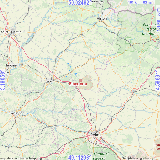
Sissonne GPS coordinates[2]
49° 34' 15.852" North, 3° 53' 37.284" East
| Map corner | latitude | longitude |
|---|---|---|
| Upper-left | 50.02492°, | 3.19056° |
| Center: | 49.57107°, | 3.89369° |
| Lower-right: | 49.11296°, | 4.59681° |
| Map W x H: | 101.4×101.4 km | = 63×63mi |
| max Lat: | 51.07786° ⇑9.8% North |
| Sissonne: | 49.57107° |
| min Lat: | ⇓90.2% South 41.3874° |
| min Long | Sissonne | max Long |
| -5.08615° | 3.89369° | 9.52242° |
| W 66.9%⇐ | ⇒33.1% E |
Elevation
Elevation of Sissonne is 76 m = 249 ft, and this is 117.7 m = 386 ft below average elevation for this country.
| Max E: |
2333 m = 7654 ft | 71% |
| Avg. | 193.7 m = 635 ft | |
| Sissonne | 76 m = 249 ft | |
Min E: |
-1 m = -3 ft | 29% |
See also: France elevation on elevation.city.
Geographical zone
Sissonne is located in North temperate zone (between Tropic of Cancer and the Arctic Circle). Distance of this North polar circle is 1889.4 km =1174 mi to North.| Distance of | km | miles | from Sissonne |
|---|---|---|---|
| North Pole | 4495.3 | 2793.2 | to North |
| Arctic Circle | 1889.4 | 1174 | to North |
| Tropic Cancer | 2905.9 | 1805.6 | to South |
| Equator | 5511.8 | 3424.9 | to South |


Nearby cities:
15 places around Sissonne: (largest is in red/bold)
• Athies-sous-Laon
15.1 km =9.4 mi,  271°
271°
• Bruyères-et-Montbérault
17.4 km =10.8 mi,  252°
252°
• Chambry
17.2 km =10.7 mi,  278°
278°
• Chaourse
16.7 km =10.4 mi,  27°
27°
• Corbeny
13.1 km =8.1 mi,  202°
202°
• Coucy-lès-Eppes
8.9 km =5.5 mi,  257°
257°
• Dizy-le-Gros
11.4 km =7.1 mi,  55°
55°
• Festieux
11.3 km =7 mi,  241°
241°
• Gizy
9.2 km =5.7 mi,  291°
291°
• Guignicourt
15.8 km =9.8 mi,  160°
160°
• Liesse-Notre-Dame
8.4 km =5.2 mi,  306°
306°
• Montaigu
6 km =3.7 mi,  228°
228°
• Montcornet
16.4 km =10.2 mi, 32°
• Saint-Erme-Outre-et-Ramecourt
7.4 km =4.6 mi,  211°
211°
• Tavaux-et-Pontséricourt
17.7 km =11 mi,  2°
2°
Sources, notices
• [Note1] Compared only with cities in France existing in our database
• [Src1] Map data: © OpenStreetMap contributors (CC-BY-SA)
• [Src2] Other city data from geonames.org with taken over terms of usage.
• [Src3] Geographical zone / Annual Mean Temperature by Robert A. Rohde @ Wikipedia
