Taugon geodata
Taugon (Nouvelle-Aquitaine) is a populated place; located in France in Europe/Paris (GMT+2) time zone. With population of 627 people, there are 12867 cities with bigger population in this country. Compared to other cities in France, 62.2% of cities are located further ↑North; 86.7% of cities are located further →East and 98.6% of cities have higher elevation than Taugon. Note1
Administrative division(s):
- Level 1: Nouvelle-Aquitaine
- Level 2: Charente-Maritime
- Level 3: Arrondissement de La Rochelle
- Level 4: Taugon


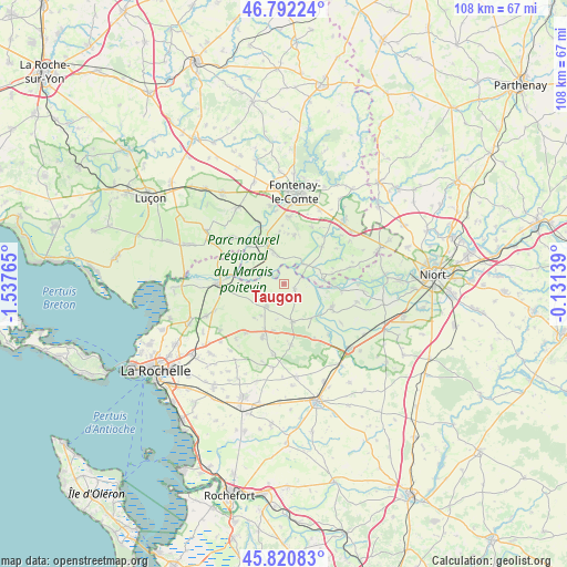
Taugon GPS coordinates[2]
46° 18' 31.284" North, 0° 50' 4.272" West
| Map corner | latitude | longitude |
|---|---|---|
| Upper-left | 46.79224°, | -1.53765° |
| Center: | 46.30869°, | -0.83452° |
| Lower-right: | 45.82083°, | -0.13139° |
| Map W x H: | 108×108 km | = 67.1×67.1mi |
| max Lat: | 51.07786° ⇑62.2% North |
| Taugon: | 46.30869° |
| min Lat: | ⇓37.8% South 41.3874° |
| min Long | Taugon | max Long |
| -5.08615° | -0.83452° | 9.52242° |
| W 13.3%⇐ | ⇒86.7% E |
Elevation
Elevation of Taugon is 7 m = 23 ft, and this is 186.7 m = 613 ft below average elevation for this country.
| Max E: |
2333 m = 7654 ft | 98.6% |
| Avg. | 193.7 m = 635 ft | |
| Taugon | 7 m = 23 ft | |
Min E: |
-1 m = -3 ft | 1.4% |
See also: France elevation on elevation.city.
Geographical zone
Taugon is located in North temperate zone (between Tropic of Cancer and the Arctic Circle). Distance of this North polar circle is 2252.1 km =1399.4 mi to North.| Distance of | km | miles | from Taugon |
|---|---|---|---|
| North Pole | 4858 | 3018.6 | to North |
| Arctic Circle | 2252.1 | 1399.4 | to North |
| Tropic Cancer | 2543.1 | 1580.2 | to South |
| Equator | 5149 | 3199.4 | to South |


Nearby cities:
15 places around Taugon: (largest is in red/bold)
• Arçais
11.1 km =6.9 mi,  96°
96°
• Benon
11.6 km =7.2 mi,  173°
173°
• Courçon
7.4 km =4.6 mi, 167°
• Damvix
7.8 km =4.8 mi,  84°
84°
• Doix
9.6 km =6 mi,  13°
13°
• La Ronde
2.4 km =1.5 mi,  117°
117°
• Le Gué-de-Velluire
9.2 km =5.7 mi,  319°
319°
• Maillezais
10.2 km =6.3 mi,  45°
45°
• Maillé
5.2 km =3.2 mi,  44°
44°
• Montreuil
11 km =6.8 mi,  358°
358°
• Saint-Hilaire-la-Palud
10.6 km =6.6 mi, 118°
• Saint-Jean-de-Liversay
5.4 km =3.4 mi,  214°
214°
• Saint-Pierre-le-Vieux
10.9 km =6.8 mi, 37°
• Saint-Sauveur-d’Aunis
10.9 km =6.8 mi,  201°
201°
• Vix
6.5 km =4 mi,  342°
342°
Sources, notices
• [Note1] Compared only with cities in France existing in our database
• [Src1] Map data: © OpenStreetMap contributors (CC-BY-SA)
• [Src2] Other city data from geonames.org with taken over terms of usage.
• [Src3] Geographical zone / Annual Mean Temperature by Robert A. Rohde @ Wikipedia
