Tagnon geodata
Tagnon (Grand Est) is a populated place; located in France in Europe/Paris (GMT+2) time zone. With population of 742 people, there are 11263 cities with bigger population in this country. Compared to other cities in France, 88.4% of cities are located further ↓South; 70.5% of cities are located further ←West and 59.1% of cities have higher elevation than Tagnon. Note1
Administrative division(s):
- Level 1: Grand Est
- Level 2: Ardennes
- Level 3: Arrondissement de Rethel
- Level 4: Tagnon


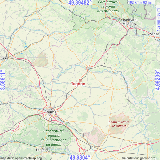
Tagnon GPS coordinates[2]
49° 26' 23.064" North, 4° 17' 21.228" East
| Map corner | latitude | longitude |
|---|---|---|
| Upper-left | 49.89482°, | 3.58611° |
| Center: | 49.43974°, | 4.28923° |
| Lower-right: | 48.9804°, | 4.99236° |
| Map W x H: | 101.7×101.7 km | = 63.2×63.2mi |
| max Lat: | 51.07786° ⇑11.6% North |
| Tagnon: | 49.43974° |
| min Lat: | ⇓88.4% South 41.3874° |
| min Long | Tagnon | max Long |
| -5.08615° | 4.28923° | 9.52242° |
| W 70.5%⇐ | ⇒29.5% E |
Elevation
Elevation of Tagnon is 105 m = 344 ft, and this is 88.7 m = 291 ft below average elevation for this country.
| Max E: |
2333 m = 7654 ft | 59.1% |
| Avg. | 193.7 m = 635 ft | |
| Tagnon | 105 m = 344 ft | |
Min E: |
-1 m = -3 ft | 40.9% |
See also: France elevation on elevation.city.
Geographical zone
Tagnon is located in North temperate zone (between Tropic of Cancer and the Arctic Circle). Distance of this North polar circle is 1904 km =1183.1 mi to North.| Distance of | km | miles | from Tagnon |
|---|---|---|---|
| North Pole | 4509.9 | 2802.3 | to North |
| Arctic Circle | 1904 | 1183.1 | to North |
| Tropic Cancer | 2891.3 | 1796.6 | to South |
| Equator | 5497.2 | 3415.8 | to South |


Nearby cities:
15 places around Tagnon: (largest is in red/bold)
• Acy-Romance
7.8 km =4.8 mi,  29°
29°
• Asfeld
12.9 km =8 mi,  285°
285°
• Bazancourt
11.9 km =7.4 mi,  226°
226°
• Boult-sur-Suippe
12.8 km =8 mi, 233°
• Château-Porcien
10.2 km =6.3 mi,  341°
341°
• Isles-sur-Suippe
11.3 km =7 mi,  214°
214°
• Juniville
8.3 km =5.2 mi,  125°
125°
• Le Châtelet-sur-Retourne
2.8 km =1.7 mi,  195°
195°
• Neuflize
3.6 km =2.2 mi,  158°
158°
• Novy-Chevrières
15.8 km =9.8 mi,  45°
45°
• Rethel
9.6 km =6 mi,  35°
35°
• Saint-Germainmont
13.7 km =8.5 mi,  304°
304°
• Saint-Masmes
14.3 km =8.9 mi,  187°
187°
• Sault-lès-Rethel
8.5 km =5.3 mi, 38°
• Warmeriville
11 km =6.8 mi, 207°
Sources, notices
• [Note1] Compared only with cities in France existing in our database
• [Src1] Map data: © OpenStreetMap contributors (CC-BY-SA)
• [Src2] Other city data from geonames.org with taken over terms of usage.
• [Src3] Geographical zone / Annual Mean Temperature by Robert A. Rohde @ Wikipedia
