Isles-sur-Suippe geodata
Isles-sur-Suippe (Grand Est) is a populated place; located in France in Europe/Paris (GMT+2) time zone. With population of 674 people, there are 12156 cities with bigger population in this country. Compared to other cities in France, 87.1% of cities are located further ↓South; 69.7% of cities are located further ←West and 69.7% of cities have higher elevation than Isles-sur-Suippe. Note1
Administrative division(s):
- Level 1: Grand Est
- Level 2: Marne
- Level 3: Arrondissement de Reims
- Level 4: Isles-sur-Suippe


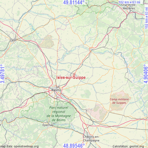
Isles-sur-Suippe GPS coordinates[2]
49° 21' 20.088" North, 4° 12' 3.348" East
| Map corner | latitude | longitude |
|---|---|---|
| Upper-left | 49.81144°, | 3.49781° |
| Center: | 49.35558°, | 4.20093° |
| Lower-right: | 48.89546°, | 4.90406° |
| Map W x H: | 101.8×101.8 km | = 63.3×63.3mi |
| max Lat: | 51.07786° ⇑12.9% North |
| Isles-sur-Suippe: | 49.35558° |
| min Lat: | ⇓87.1% South 41.3874° |
| min Long | Isles-sur-Suipp | max Long |
| -5.08615° | 4.20093° | 9.52242° |
| W 69.7%⇐ | ⇒30.3% E |
Elevation
Elevation of Isles-sur-Suippe is 79 m = 259 ft, and this is 114.7 m = 376 ft below average elevation for this country.
| Max E: |
2333 m = 7654 ft | 69.7% |
| Avg. | 193.7 m = 635 ft | |
| Isles-sur-Suippe | 79 m = 259 ft | |
Min E: |
-1 m = -3 ft | 30.3% |
See also: France elevation on elevation.city.
Geographical zone
Isles-sur-Suippe is located in North temperate zone (between Tropic of Cancer and the Arctic Circle). Distance of this North polar circle is 1913.3 km =1188.9 mi to North.| Distance of | km | miles | from Isles-sur-Suippe |
|---|---|---|---|
| North Pole | 4519.2 | 2808.1 | to North |
| Arctic Circle | 1913.3 | 1188.9 | to North |
| Tropic Cancer | 2881.9 | 1790.7 | to South |
| Equator | 5487.8 | 3410 | to South |


Nearby cities:
15 places around Isles-sur-Suippe: (largest is in red/bold)
• Auménancourt-le-Petit
10.5 km =6.5 mi,  282°
282°
• Bazancourt
2.5 km =1.6 mi,  296°
296°
• Beine-Nauroy
11.9 km =7.4 mi,  174°
174°
• Boult-sur-Suippe
4.3 km =2.7 mi,  294°
294°
• Bourgogne
9.4 km =5.8 mi,  265°
265°
• Bétheny
13.2 km =8.2 mi,  233°
233°
• Caurel
6.7 km =4.2 mi,  211°
211°
• Cernay-lès-Reims
12.5 km =7.8 mi,  215°
215°
• Le Châtelet-sur-Retourne
8.7 km =5.4 mi,  40°
40°
• Neuflize
9.8 km =6.1 mi,  52°
52°
• Pontfaverger-Moronvilliers
10.6 km =6.6 mi,  127°
127°
• Saint-Masmes
6.5 km =4 mi,  137°
137°
• Tagnon
11.3 km =7 mi,  34°
34°
• Warmeriville
1.3 km =0.8 mi,  105°
105°
• Witry-lès-Reims
9.3 km =5.8 mi, 219°
Sources, notices
• [Note1] Compared only with cities in France existing in our database
• [Src1] Map data: © OpenStreetMap contributors (CC-BY-SA)
• [Src2] Other city data from geonames.org with taken over terms of usage.
• [Src3] Geographical zone / Annual Mean Temperature by Robert A. Rohde @ Wikipedia
