Taden geodata
Taden (Brittany) is a populated place; located in France in Europe/Paris (GMT+2) time zone. With population of 1,909 people, there are 5011 cities with bigger population in this country. Compared to other cities in France, 67.8% of cities are located further ↓South; 94.9% of cities are located further →East and 82.2% of cities have higher elevation than Taden. Note1
Administrative division(s):
- Level 1: Brittany
- Level 2: Département des Côtes-d’Armor
- Level 3: Arrondissement de Dinan
- Level 4: Taden


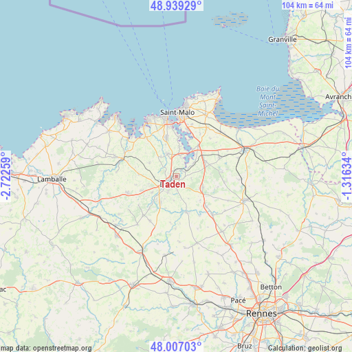
Taden GPS coordinates[2]
48° 28' 31.08" North, 2° 1' 10.056" West
| Map corner | latitude | longitude |
|---|---|---|
| Upper-left | 48.93929°, | -2.72259° |
| Center: | 48.4753°, | -2.01946° |
| Lower-right: | 48.00703°, | -1.31634° |
| Map W x H: | 103.7×103.7 km | = 64.4×64.4mi |
| max Lat: | 51.07786° ⇑32.2% North |
| Taden: | 48.4753° |
| min Lat: | ⇓67.8% South 41.3874° |
| min Long | Taden | max Long |
| -5.08615° | -2.01946° | 9.52242° |
| W 5.1%⇐ | ⇒94.9% E |
Elevation
Elevation of Taden is 49 m = 161 ft, and this is 144.7 m = 475 ft below average elevation for this country.
| Max E: |
2333 m = 7654 ft | 82.2% |
| Avg. | 193.7 m = 635 ft | |
| Taden | 49 m = 161 ft | |
Min E: |
-1 m = -3 ft | 17.8% |
See also: France elevation on elevation.city.
Geographical zone
Taden is located in North temperate zone (between Tropic of Cancer and the Arctic Circle). Distance of this North polar circle is 2011.2 km =1249.7 mi to North.| Distance of | km | miles | from Taden |
|---|---|---|---|
| North Pole | 4617.1 | 2868.9 | to North |
| Arctic Circle | 2011.2 | 1249.7 | to North |
| Tropic Cancer | 2784 | 1729.9 | to South |
| Equator | 5389.9 | 3349.1 | to South |


Nearby cities:
15 places around Taden: (largest is in red/bold)
• Aucaleuc
8.5 km =5.3 mi,  254°
254°
• Dinan
3.2 km =2 mi,  225°
225°
• La Vicomté-sur-Rance
3.3 km =2.1 mi,  57°
57°
• Langrolay-sur-Rance
8.4 km =5.2 mi,  9°
9°
• Lanvallay
2.3 km =1.4 mi,  195°
195°
• Les Champs-Géraux
7.5 km =4.7 mi,  151°
151°
• Léhon
4 km =2.5 mi,  209°
209°
• Pleslin-Trigavou
7.3 km =4.5 mi,  331°
331°
• Pleudihen-sur-Rance
6 km =3.7 mi,  40°
40°
• Plouër-sur-Rance
5.8 km =3.6 mi, 11°
• Quévert
5.2 km =3.2 mi,  255°
255°
• Saint-Carné
7.6 km =4.7 mi, 208°
• Saint-Hélen
4.5 km =2.8 mi,  97°
97°
• Saint-Pierre-de-Plesguen
8.5 km =5.3 mi,  112°
112°
• Saint-Samson-sur-Rance
2 km =1.2 mi,  340°
340°
Sources, notices
• [Note1] Compared only with cities in France existing in our database
• [Src1] Map data: © OpenStreetMap contributors (CC-BY-SA)
• [Src2] Other city data from geonames.org with taken over terms of usage.
• [Src3] Geographical zone / Annual Mean Temperature by Robert A. Rohde @ Wikipedia
