Spechbach-le-Bas geodata
Spechbach-le-Bas (Grand Est) is a populated place; located in France in Europe/Paris (GMT+2) time zone. With population of 772 people, there are 10917 cities with bigger population in this country. Compared to other cities in France, 53.8% of cities are located further ↓South; 96% of cities are located further ←West and 77.6% of cities have lower elevation than Spechbach-le-Bas. Note1
Administrative division(s):
- Level 1: Grand Est
- Level 2: Haut-Rhin
- Level 3: Altkirch
- Level 4: Spechbach


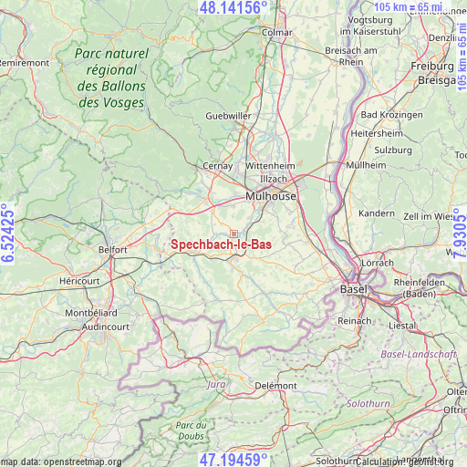
Spechbach-le-Bas GPS coordinates[2]
47° 40' 12.792" North, 7° 13' 38.532" East
| Map corner | latitude | longitude |
|---|---|---|
| Upper-left | 48.14156°, | 6.52425° |
| Center: | 47.67022°, | 7.22737° |
| Lower-right: | 47.19459°, | 7.9305° |
| Map W x H: | 105.3×105.3 km | = 65.4×65.4mi |
| max Lat: | 51.07786° ⇑46.2% North |
| Spechbach-le-Bas: | 47.67022° |
| min Lat: | ⇓53.8% South 41.3874° |
| min Long | Spechbach-le-Ba | max Long |
| -5.08615° | 7.22737° | 9.52242° |
| W 96%⇐ | ⇒4% E |
Elevation
Elevation of Spechbach-le-Bas is 269 m = 883 ft, and this is 75.3 m = 247 ft above average elevation for this country.
| Max E: |
2333 m = 7654 ft | 22.4% |
| Spechbach-le-Bas | 269 m 883 ft | |
| Avg. | 193.7 m = 635 ft | |
Min E: |
-1 m = -3 ft | 77.6% |
See also: France elevation on elevation.city.
Geographical zone
Spechbach-le-Bas is located in North temperate zone (between Tropic of Cancer and the Arctic Circle). Distance of this North polar circle is 2100.7 km =1305.3 mi to North.| Distance of | km | miles | from Spechbach-le-Bas |
|---|---|---|---|
| North Pole | 4706.6 | 2924.5 | to North |
| Arctic Circle | 2100.7 | 1305.3 | to North |
| Tropic Cancer | 2694.5 | 1674.3 | to South |
| Equator | 5300.4 | 3293.5 | to South |


Nearby cities:
15 places around Spechbach-le-Bas: (largest is in red/bold)
• Altkirch
5.2 km =3.2 mi,  169°
169°
• Aspach
3.1 km =1.9 mi, 171°
• Balschwiller
4.4 km =2.7 mi,  271°
271°
• Bernwiller
3.7 km =2.3 mi,  309°
309°
• Frœningen
3.3 km =2.1 mi,  63°
63°
• Galfingue
4 km =2.5 mi,  356°
356°
• Hagenbach
5.7 km =3.5 mi,  245°
245°
• Heidwiller
1.5 km =0.9 mi,  143°
143°
• Hochstatt
5.2 km =3.2 mi,  44°
44°
• Illfurth
2.9 km =1.8 mi,  81°
81°
• Luemschwiller
4.8 km =3 mi,  110°
110°
• Spechbach-le-Haut
1.6 km =1 mi,  326°
326°
• Tagolsheim
3.5 km =2.2 mi, 114°
• Walheim
4.3 km =2.7 mi, 135°
• Zillisheim
6 km =3.7 mi, 61°
Sources, notices
• [Note1] Compared only with cities in France existing in our database
• [Src1] Map data: © OpenStreetMap contributors (CC-BY-SA)
• [Src2] Other city data from geonames.org with taken over terms of usage.
• [Src3] Geographical zone / Annual Mean Temperature by Robert A. Rohde @ Wikipedia
