Bernwiller geodata
Bernwiller (Grand Est) is a populated place; located in France in Europe/Paris (GMT+2) time zone. With population of 616 people, there are 13048 cities with bigger population in this country. Compared to other cities in France, 54.1% of cities are located further ↓South; 95.7% of cities are located further ←West and 79.4% of cities have lower elevation than Bernwiller. Note1
Administrative division(s):
- Level 1: Grand Est
- Level 2: Haut-Rhin
- Level 3: Altkirch
- Level 4: Bernwiller


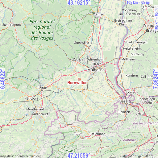
Bernwiller GPS coordinates[2]
47° 41' 27.6" North, 7° 11' 21.66" East
| Map corner | latitude | longitude |
|---|---|---|
| Upper-left | 48.16215°, | 6.48622° |
| Center: | 47.691°, | 7.18935° |
| Lower-right: | 47.21556°, | 7.89247° |
| Map W x H: | 105.3×105.2 km | = 65.4×65.4mi |
| max Lat: | 51.07786° ⇑45.9% North |
| Bernwiller: | 47.691° |
| min Lat: | ⇓54.1% South 41.3874° |
| min Long | Bernwiller | max Long |
| -5.08615° | 7.18935° | 9.52242° |
| W 95.7%⇐ | ⇒4.3% E |
Elevation
Elevation of Bernwiller is 284 m = 932 ft, and this is 90.3 m = 296 ft above average elevation for this country.
| Max E: |
2333 m = 7654 ft | 20.6% |
| Bernwiller | 284 m 932 ft | |
| Avg. | 193.7 m = 635 ft | |
Min E: |
-1 m = -3 ft | 79.4% |
See also: France elevation on elevation.city.
Geographical zone
Bernwiller is located in North temperate zone (between Tropic of Cancer and the Arctic Circle). Distance of this North polar circle is 2098.4 km =1303.9 mi to North.| Distance of | km | miles | from Bernwiller |
|---|---|---|---|
| North Pole | 4704.3 | 2923.1 | to North |
| Arctic Circle | 2098.4 | 1303.9 | to North |
| Tropic Cancer | 2696.8 | 1675.7 | to South |
| Equator | 5302.7 | 3294.9 | to South |


Nearby cities:
15 places around Bernwiller: (largest is in red/bold)
• Aspach
6.3 km =3.9 mi,  148°
148°
• Balschwiller
2.7 km =1.7 mi,  214°
214°
• Burnhaupt-le-Bas
3.6 km =2.2 mi,  324°
324°
• Burnhaupt-le-Haut
5.6 km =3.5 mi, 323°
• Frœningen
5.8 km =3.6 mi,  98°
98°
• Galfingue
3.1 km =1.9 mi,  57°
57°
• Hagenbach
5.2 km =3.2 mi, 206°
• Heidwiller
5.1 km =3.2 mi,  133°
133°
• Heimsbrunn
4.9 km =3 mi,  35°
35°
• Hochstatt
6.7 km =4.2 mi,  77°
77°
• Illfurth
6 km =3.7 mi,  108°
108°
• Schweighouse-Thann
7.1 km =4.4 mi,  345°
345°
• Spechbach-le-Bas
3.7 km =2.3 mi, 129°
• Spechbach-le-Haut
2.2 km =1.4 mi,  116°
116°
• Tagolsheim
7.1 km =4.4 mi, 121°
Sources, notices
• [Note1] Compared only with cities in France existing in our database
• [Src1] Map data: © OpenStreetMap contributors (CC-BY-SA)
• [Src2] Other city data from geonames.org with taken over terms of usage.
• [Src3] Geographical zone / Annual Mean Temperature by Robert A. Rohde @ Wikipedia
