Heidwiller geodata
Heidwiller (Grand Est) is a populated place; located in France in Europe/Paris (GMT+2) time zone. With population of 635 people, there are 12740 cities with bigger population in this country. Compared to other cities in France, 53.6% of cities are located further ↓South; 96% of cities are located further ←West and 78.5% of cities have lower elevation than Heidwiller. Note1
Administrative division(s):
- Level 1: Grand Est
- Level 2: Haut-Rhin
- Level 3: Altkirch
- Level 4: Heidwiller


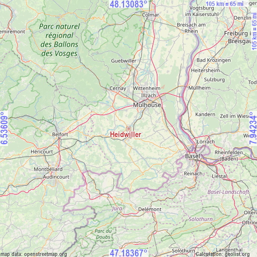
Heidwiller GPS coordinates[2]
47° 39' 33.84" North, 7° 14' 21.192" East
| Map corner | latitude | longitude |
|---|---|---|
| Upper-left | 48.13083°, | 6.53609° |
| Center: | 47.6594°, | 7.23922° |
| Lower-right: | 47.18367°, | 7.94234° |
| Map W x H: | 105.3×105.3 km | = 65.4×65.4mi |
| max Lat: | 51.07786° ⇑46.4% North |
| Heidwiller: | 47.6594° |
| min Lat: | ⇓53.6% South 41.3874° |
| min Long | Heidwiller | max Long |
| -5.08615° | 7.23922° | 9.52242° |
| W 96%⇐ | ⇒4% E |
Elevation
Elevation of Heidwiller is 276 m = 906 ft, and this is 82.3 m = 270 ft above average elevation for this country.
| Max E: |
2333 m = 7654 ft | 21.5% |
| Heidwiller | 276 m 906 ft | |
| Avg. | 193.7 m = 635 ft | |
Min E: |
-1 m = -3 ft | 78.5% |
See also: France elevation on elevation.city.
Geographical zone
Heidwiller is located in North temperate zone (between Tropic of Cancer and the Arctic Circle). Distance of this North polar circle is 2101.9 km =1306.1 mi to North.| Distance of | km | miles | from Heidwiller |
|---|---|---|---|
| North Pole | 4707.8 | 2925.3 | to North |
| Arctic Circle | 2101.9 | 1306.1 | to North |
| Tropic Cancer | 2693.3 | 1673.5 | to South |
| Equator | 5299.2 | 3292.8 | to South |


Nearby cities:
15 places around Heidwiller: (largest is in red/bold)
• Altkirch
3.9 km =2.4 mi,  179°
179°
• Aspach
1.9 km =1.2 mi,  192°
192°
• Balschwiller
5.4 km =3.4 mi,  283°
283°
• Bernwiller
5.1 km =3.2 mi,  313°
313°
• Carspach
5.3 km =3.3 mi,  204°
204°
• Frœningen
3.4 km =2.1 mi,  37°
37°
• Galfingue
5.3 km =3.3 mi,  347°
347°
• Hochstatt
5.7 km =3.5 mi,  29°
29°
• Illfurth
2.6 km =1.6 mi,  50°
50°
• Luemschwiller
3.6 km =2.2 mi,  98°
98°
• Spechbach-le-Bas
1.5 km =0.9 mi,  323°
323°
• Spechbach-le-Haut
3.1 km =1.9 mi,  325°
325°
• Tagolsheim
2.4 km =1.5 mi, 95°
• Walheim
2.8 km =1.7 mi,  131°
131°
• Wittersdorf
4.9 km =3 mi,  147°
147°
Sources, notices
• [Note1] Compared only with cities in France existing in our database
• [Src1] Map data: © OpenStreetMap contributors (CC-BY-SA)
• [Src2] Other city data from geonames.org with taken over terms of usage.
• [Src3] Geographical zone / Annual Mean Temperature by Robert A. Rohde @ Wikipedia
