Soulgé-sur-Ouette geodata
Soulgé-sur-Ouette (Pays de la Loire) is a populated place; located in France in Europe/Paris (GMT+2) time zone. With population of 1,018 people, there are 8707 cities with bigger population in this country. Compared to other cities in France, 60.5% of cities are located further ↓South; 84.1% of cities are located further →East and 55.2% of cities have higher elevation than Soulgé-sur-Ouette. Note1
Administrative division(s):
- Level 1: Pays de la Loire
- Level 2: Mayenne
- Level 3: Arrondissement de Laval
- Level 4: Soulgé-sur-Ouette


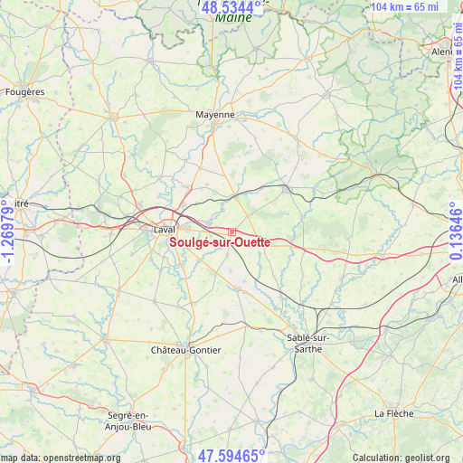
Soulgé-sur-Ouette GPS coordinates[2]
48° 4' 0.012" North, 0° 34' 0.012" West
| Map corner | latitude | longitude |
|---|---|---|
| Upper-left | 48.5344°, | -1.26979° |
| Center: | 48.06667°, | -0.56667° |
| Lower-right: | 47.59465°, | 0.13646° |
| Map W x H: | 104.5×104.5 km | = 64.9×64.9mi |
| max Lat: | 51.07786° ⇑39.5% North |
| Soulgé-sur-Ouette: | 48.06667° |
| min Lat: | ⇓60.5% South 41.3874° |
| min Long | Soulgé-sur-Oue | max Long |
| -5.08615° | -0.56667° | 9.52242° |
| W 15.9%⇐ | ⇒84.1% E |
Elevation
Elevation of Soulgé-sur-Ouette is 116 m = 381 ft, and this is 77.7 m = 255 ft below average elevation for this country.
| Max E: |
2333 m = 7654 ft | 55.2% |
| Avg. | 193.7 m = 635 ft | |
| Soulgé-sur-Ouette | 116 m = 381 ft | |
Min E: |
-1 m = -3 ft | 44.8% |
See also: France elevation on elevation.city.
Geographical zone
Soulgé-sur-Ouette is located in North temperate zone (between Tropic of Cancer and the Arctic Circle). Distance of this North polar circle is 2056.7 km =1278 mi to North.| Distance of | km | miles | from Soulgé-sur-Ouette |
|---|---|---|---|
| North Pole | 4662.5 | 2897.1 | to North |
| Arctic Circle | 2056.7 | 1278 | to North |
| Tropic Cancer | 2738.6 | 1701.7 | to South |
| Equator | 5344.5 | 3320.9 | to South |


Nearby cities:
15 places around Soulgé-sur-Ouette: (largest is in red/bold)
• Argentré
5.9 km =3.7 mi,  288°
288°
• Arquenay
8.9 km =5.5 mi,  181°
181°
• Bazougers
5.6 km =3.5 mi,  191°
191°
• Bonchamp-lès-Laval
9.9 km =6.2 mi,  274°
274°
• Châtres-la-Forêt
12.5 km =7.8 mi,  53°
53°
• Forcé
10.6 km =6.6 mi,  249°
249°
• La Chapelle-Anthenaise
10.3 km =6.4 mi,  307°
307°
• Louverné
12.7 km =7.9 mi,  298°
298°
• Louvigné
4.9 km =3 mi,  258°
258°
• Meslay-du-Maine
12.9 km =8 mi, 175°
• Montsûrs
7.8 km =4.8 mi,  6°
6°
• Neau
12 km =7.5 mi,  34°
34°
• Parné-sur-Roc
10.1 km =6.3 mi,  228°
228°
• Saint-Christophe-du-Luat
10.7 km =6.6 mi, 47°
• Vaiges
7.4 km =4.6 mi,  113°
113°
Sources, notices
• [Note1] Compared only with cities in France existing in our database
• [Src1] Map data: © OpenStreetMap contributors (CC-BY-SA)
• [Src2] Other city data from geonames.org with taken over terms of usage.
• [Src3] Geographical zone / Annual Mean Temperature by Robert A. Rohde @ Wikipedia
