Louverné geodata
Louverné (Pays de la Loire) is a populated place; located in France in Europe/Paris (GMT+2) time zone. With population of 3,077 people, there are 3170 cities with bigger population in this country. Compared to other cities in France, 61.6% of cities are located further ↓South; 85.7% of cities are located further →East and 56.5% of cities have higher elevation than Louverné. Note1
Administrative division(s):
- Level 1: Pays de la Loire
- Level 2: Mayenne
- Level 3: Arrondissement de Laval
- Level 4: Louverné


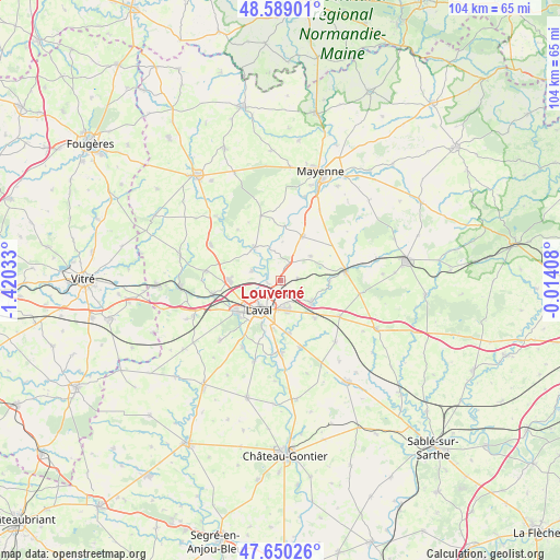
Louverné GPS coordinates[2]
48° 7' 18.408" North, 0° 43' 1.956" West
| Map corner | latitude | longitude |
|---|---|---|
| Upper-left | 48.58901°, | -1.42033° |
| Center: | 48.12178°, | -0.71721° |
| Lower-right: | 47.65026°, | -0.01408° |
| Map W x H: | 104.4×104.4 km | = 64.9×64.9mi |
| max Lat: | 51.07786° ⇑38.4% North |
| Louverné: | 48.12178° |
| min Lat: | ⇓61.6% South 41.3874° |
| min Long | Louverné | max Long |
| -5.08615° | -0.71721° | 9.52242° |
| W 14.3%⇐ | ⇒85.7% E |
Elevation
Elevation of Louverné is 112 m = 367 ft, and this is 81.7 m = 268 ft below average elevation for this country.
| Max E: |
2333 m = 7654 ft | 56.5% |
| Avg. | 193.7 m = 635 ft | |
| Louverné | 112 m = 367 ft | |
Min E: |
-1 m = -3 ft | 43.5% |
See also: France elevation on elevation.city.
Geographical zone
Louverné is located in North temperate zone (between Tropic of Cancer and the Arctic Circle). Distance of this North polar circle is 2050.5 km =1274.1 mi to North.| Distance of | km | miles | from Louverné |
|---|---|---|---|
| North Pole | 4656.4 | 2893.4 | to North |
| Arctic Circle | 2050.5 | 1274.1 | to North |
| Tropic Cancer | 2744.7 | 1705.5 | to South |
| Equator | 5350.6 | 3324.7 | to South |


Nearby cities:
15 places around Louverné: (largest is in red/bold)
• Andouillé
7.9 km =4.9 mi,  321°
321°
• Argentré
7 km =4.3 mi,  127°
127°
• Bonchamp-lès-Laval
5.5 km =3.4 mi,  166°
166°
• Changé
6.2 km =3.9 mi,  245°
245°
• Forcé
9.9 km =6.2 mi, 172°
• La Chapelle-Anthenaise
3 km =1.9 mi,  87°
87°
• Laval
6.4 km =4 mi,  212°
212°
• Louvigné
9.6 km =6 mi,  138°
138°
• Martigné-sur-Mayenne
9.5 km =5.9 mi,  23°
23°
• Montsûrs
12.2 km =7.6 mi,  82°
82°
• Parné-sur-Roc
13.3 km =8.3 mi,  164°
164°
• Saint-Berthevin
10.6 km =6.6 mi,  234°
234°
• Saint-Germain-le-Fouilloux
5.7 km =3.5 mi,  286°
286°
• Saint-Jean-sur-Mayenne
3.3 km =2.1 mi,  297°
297°
• Soulgé-sur-Ouette
12.7 km =7.9 mi,  118°
118°
Sources, notices
• [Note1] Compared only with cities in France existing in our database
• [Src1] Map data: © OpenStreetMap contributors (CC-BY-SA)
• [Src2] Other city data from geonames.org with taken over terms of usage.
• [Src3] Geographical zone / Annual Mean Temperature by Robert A. Rohde @ Wikipedia
