Bazougers geodata
Bazougers (Pays de la Loire) is a populated place; located in France in Europe/Paris (GMT+2) time zone. With population of 981 people, there are 8981 cities with bigger population in this country. Compared to other cities in France, 59.5% of cities are located further ↓South; 84.3% of cities are located further →East and 66.6% of cities have higher elevation than Bazougers. Note1
Administrative division(s):
- Level 1: Pays de la Loire
- Level 2: Mayenne
- Level 3: Arrondissement de Château-Gontier
- Level 4: Bazougers


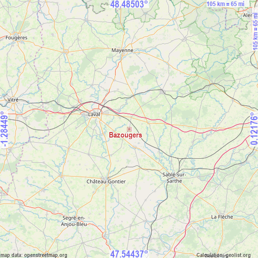
Bazougers GPS coordinates[2]
48° 1' 0.66" North, 0° 34' 52.932" West
| Map corner | latitude | longitude |
|---|---|---|
| Upper-left | 48.48503°, | -1.28449° |
| Center: | 48.01685°, | -0.58137° |
| Lower-right: | 47.54437°, | 0.12176° |
| Map W x H: | 104.6×104.6 km | = 65×65mi |
| max Lat: | 51.07786° ⇑40.5% North |
| Bazougers: | 48.01685° |
| min Lat: | ⇓59.5% South 41.3874° |
| min Long | Bazougers | max Long |
| -5.08615° | -0.58137° | 9.52242° |
| W 15.7%⇐ | ⇒84.3% E |
Elevation
Elevation of Bazougers is 86 m = 282 ft, and this is 107.7 m = 353 ft below average elevation for this country.
| Max E: |
2333 m = 7654 ft | 66.6% |
| Avg. | 193.7 m = 635 ft | |
| Bazougers | 86 m = 282 ft | |
Min E: |
-1 m = -3 ft | 33.4% |
See also: France elevation on elevation.city.
Geographical zone
Bazougers is located in North temperate zone (between Tropic of Cancer and the Arctic Circle). Distance of this North polar circle is 2062.2 km =1281.4 mi to North.| Distance of | km | miles | from Bazougers |
|---|---|---|---|
| North Pole | 4668.1 | 2900.6 | to North |
| Arctic Circle | 2062.2 | 1281.4 | to North |
| Tropic Cancer | 2733.1 | 1698.3 | to South |
| Equator | 5339 | 3317.5 | to South |


Nearby cities:
15 places around Bazougers: (largest is in red/bold)
• Argentré
8.7 km =5.4 mi,  328°
328°
• Arquenay
3.4 km =2.1 mi,  165°
165°
• Ballée
15.3 km =9.5 mi,  127°
127°
• Bonchamp-lès-Laval
10.8 km =6.7 mi,  305°
305°
• Entrammes
10.1 km =6.3 mi,  257°
257°
• Forcé
9 km =5.6 mi,  281°
281°
• La Chapelle-Anthenaise
13.8 km =8.6 mi, 329°
• Laval
14.9 km =9.3 mi,  294°
294°
• Louvigné
5.9 km =3.7 mi,  320°
320°
• Meslay-du-Maine
7.6 km =4.7 mi,  164°
164°
• Montsûrs
13.4 km =8.3 mi,  8°
8°
• Parné-sur-Roc
6.6 km =4.1 mi, 259°
• Soulgé-sur-Ouette
5.6 km =3.5 mi, 11°
• Vaiges
8.3 km =5.2 mi,  71°
71°
• Villiers-Charlemagne
12.7 km =7.9 mi,  213°
213°
Sources, notices
• [Note1] Compared only with cities in France existing in our database
• [Src1] Map data: © OpenStreetMap contributors (CC-BY-SA)
• [Src2] Other city data from geonames.org with taken over terms of usage.
• [Src3] Geographical zone / Annual Mean Temperature by Robert A. Rohde @ Wikipedia
