Neau geodata
Neau (Pays de la Loire) is a populated place; located in France in Europe/Paris (GMT+2) time zone. With population of 746 people, there are 11210 cities with bigger population in this country. Compared to other cities in France, 62.1% of cities are located further ↓South; 83.1% of cities are located further →East and 65.3% of cities have higher elevation than Neau. Note1
Administrative division(s):
- Level 1: Pays de la Loire
- Level 2: Mayenne
- Level 3: Arrondissement de Mayenne
- Level 4: Neau


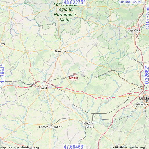
Neau GPS coordinates[2]
48° 9' 20.988" North, 0° 28' 35.436" West
| Map corner | latitude | longitude |
|---|---|---|
| Upper-left | 48.62275°, | -1.17963° |
| Center: | 48.15583°, | -0.47651° |
| Lower-right: | 47.68463°, | 0.22662° |
| Map W x H: | 104.3×104.3 km | = 64.8×64.8mi |
| max Lat: | 51.07786° ⇑37.9% North |
| Neau: | 48.15583° |
| min Lat: | ⇓62.1% South 41.3874° |
| min Long | Neau | max Long |
| -5.08615° | -0.47651° | 9.52242° |
| W 16.9%⇐ | ⇒83.1% E |
Elevation
Elevation of Neau is 89 m = 292 ft, and this is 104.7 m = 344 ft below average elevation for this country.
| Max E: |
2333 m = 7654 ft | 65.3% |
| Avg. | 193.7 m = 635 ft | |
| Neau | 89 m = 292 ft | |
Min E: |
-1 m = -3 ft | 34.7% |
See also: France elevation on elevation.city.
Geographical zone
Neau is located in North temperate zone (between Tropic of Cancer and the Arctic Circle). Distance of this North polar circle is 2046.7 km =1271.8 mi to North.| Distance of | km | miles | from Neau |
|---|---|---|---|
| North Pole | 4652.6 | 2891 | to North |
| Arctic Circle | 2046.7 | 1271.8 | to North |
| Tropic Cancer | 2748.5 | 1707.8 | to South |
| Equator | 5354.4 | 3327.1 | to South |


Nearby cities:
15 places around Neau: (largest is in red/bold)
• Argentré
14.6 km =9.1 mi,  236°
236°
• Bais
13.6 km =8.5 mi,  37°
37°
• Châtres-la-Forêt
4.2 km =2.6 mi,  126°
126°
• Commer
13.5 km =8.4 mi,  309°
309°
• Hambers
11.7 km =7.3 mi,  21°
21°
• Jublains
11.2 km =7 mi,  352°
352°
• Montsûrs
6.2 km =3.9 mi,  249°
249°
• Mézangers
5.2 km =3.2 mi, 42°
• Saint-Christophe-du-Luat
2.8 km =1.7 mi,  155°
155°
• Sainte-Gemmes-le-Robert
8.6 km =5.3 mi,  59°
59°
• Sainte-Suzanne
11.1 km =6.9 mi, 125°
• Soulgé-sur-Ouette
12 km =7.5 mi,  214°
214°
• Vaiges
12.9 km =8 mi,  179°
179°
• Voutré
13.8 km =8.6 mi,  98°
98°
• Évron
5.7 km =3.5 mi,  89°
89°
Sources, notices
• [Note1] Compared only with cities in France existing in our database
• [Src1] Map data: © OpenStreetMap contributors (CC-BY-SA)
• [Src2] Other city data from geonames.org with taken over terms of usage.
• [Src3] Geographical zone / Annual Mean Temperature by Robert A. Rohde @ Wikipedia
