Soulaire-et-Bourg geodata
Soulaire-et-Bourg (Pays de la Loire) is a populated place; located in France in Europe/Paris (GMT+2) time zone. With population of 1,257 people, there are 7244 cities with bigger population in this country. Compared to other cities in France, 52.4% of cities are located further ↓South; 84% of cities are located further →East and 79.4% of cities have higher elevation than Soulaire-et-Bourg. Note1
Administrative division(s):
- Level 1: Pays de la Loire
- Level 2: Département de Maine-et-Loire
- Level 3: Angers
- Level 4: Soulaire-et-Bourg


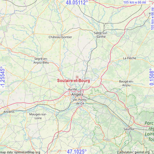
Soulaire-et-Bourg GPS coordinates[2]
47° 34' 44.256" North, 0° 33' 8.352" West
| Map corner | latitude | longitude |
|---|---|---|
| Upper-left | 48.05112°, | -1.25545° |
| Center: | 47.57896°, | -0.55232° |
| Lower-right: | 47.1025°, | 0.1508° |
| Map W x H: | 105.5×105.5 km | = 65.6×65.6mi |
| max Lat: | 51.07786° ⇑47.6% North |
| Soulaire-et-Bourg: | 47.57896° |
| min Lat: | ⇓52.4% South 41.3874° |
| min Long | Soulaire-et-Bou | max Long |
| -5.08615° | -0.55232° | 9.52242° |
| W 16%⇐ | ⇒84% E |
Elevation
Elevation of Soulaire-et-Bourg is 56 m = 184 ft, and this is 137.7 m = 452 ft below average elevation for this country.
| Max E: |
2333 m = 7654 ft | 79.4% |
| Avg. | 193.7 m = 635 ft | |
| Soulaire-et-Bourg | 56 m = 184 ft | |
Min E: |
-1 m = -3 ft | 20.6% |
See also: France elevation on elevation.city.
Geographical zone
Soulaire-et-Bourg is located in North temperate zone (between Tropic of Cancer and the Arctic Circle). Distance of this North polar circle is 2110.9 km =1311.7 mi to North.| Distance of | km | miles | from Soulaire-et-Bourg |
|---|---|---|---|
| North Pole | 4716.8 | 2930.9 | to North |
| Arctic Circle | 2110.9 | 1311.7 | to North |
| Tropic Cancer | 2684.4 | 1668 | to South |
| Equator | 5290.3 | 3287.2 | to South |


Nearby cities:
15 places around Soulaire-et-Bourg: (largest is in red/bold)
• Avrillé
9.1 km =5.7 mi,  194°
194°
• Briollay
3.8 km =2.4 mi,  114°
114°
• Cantenay-Épinard
5 km =3.1 mi, 194°
• Champigné
9.5 km =5.9 mi,  351°
351°
• Cheffes
5.7 km =3.5 mi,  43°
43°
• Feneu
3.2 km =2 mi,  256°
256°
• Grez-Neuville
10.1 km =6.3 mi,  285°
285°
• Juvardeil
9.3 km =5.8 mi,  26°
26°
• La Membrolle-sur-Longuenée
9.3 km =5.8 mi, 256°
• Le Plessis-Macé
10 km =6.2 mi,  246°
246°
• Pruillé
8.2 km =5.1 mi,  268°
268°
• Soucelles
10.1 km =6.3 mi,  96°
96°
• Tiercé
7.7 km =4.8 mi,  57°
57°
• Villevêque
9.8 km =6.1 mi, 101°
• Écouflant
5.6 km =3.5 mi,  160°
160°
Sources, notices
• [Note1] Compared only with cities in France existing in our database
• [Src1] Map data: © OpenStreetMap contributors (CC-BY-SA)
• [Src2] Other city data from geonames.org with taken over terms of usage.
• [Src3] Geographical zone / Annual Mean Temperature by Robert A. Rohde @ Wikipedia
