Sorges geodata
Sorges (Nouvelle-Aquitaine) is a populated place; located in France in Europe/Paris (GMT+2) time zone. With population of 1,165 people, there are 7732 cities with bigger population in this country. Compared to other cities in France, 76.3% of cities are located further ↑North; 70% of cities are located further →East and 61.6% of cities have lower elevation than Sorges. Note1
Administrative division(s):
- Level 1: Nouvelle-Aquitaine
- Level 2: Dordogne
- Level 3: Arrondissement de Périgueux
- Level 4: Sorges et Ligueux en Périgord


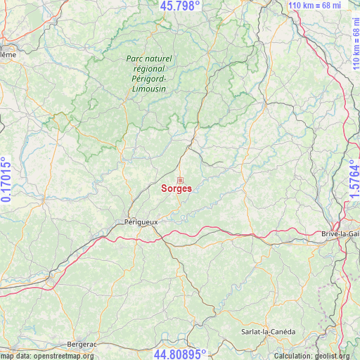
Sorges GPS coordinates[2]
45° 18' 20.268" North, 0° 52' 23.808" East
| Map corner | latitude | longitude |
|---|---|---|
| Upper-left | 45.798°, | 0.17015° |
| Center: | 45.30563°, | 0.87328° |
| Lower-right: | 44.80895°, | 1.5764° |
| Map W x H: | 110×110 km | = 68.4×68.4mi |
| max Lat: | 51.07786° ⇑76.3% North |
| Sorges: | 45.30563° |
| min Lat: | ⇓23.7% South 41.3874° |
| min Long | Sorges | max Long |
| -5.08615° | 0.87328° | 9.52242° |
| W 30%⇐ | ⇒70% E |
Elevation
Elevation of Sorges is 178 m = 584 ft, and this is 15.7 m = 52 ft below average elevation for this country.
| Max E: |
2333 m = 7654 ft | 38.4% |
| Avg. | 193.7 m = 635 ft | |
| Sorges | 178 m = 584 ft | |
Min E: |
-1 m = -3 ft | 61.6% |
See also: France elevation on elevation.city.
Geographical zone
Sorges is located in North temperate zone (between Tropic of Cancer and the Arctic Circle). Distance of this North polar circle is 2363.7 km =1468.7 mi to North.| Distance of | km | miles | from Sorges |
|---|---|---|---|
| North Pole | 4969.5 | 3087.9 | to North |
| Arctic Circle | 2363.7 | 1468.7 | to North |
| Tropic Cancer | 2431.6 | 1510.9 | to South |
| Equator | 5037.5 | 3130.2 | to South |


Nearby cities:
15 places around Sorges: (largest is in red/bold)
• Agonac
9.7 km =6 mi,  261°
261°
• Antonne-et-Trigonant
10.9 km =6.8 mi,  198°
198°
• Bassillac
13.3 km =8.3 mi, 199°
• Cornille
9.3 km =5.8 mi,  229°
229°
• Coulaures
8.3 km =5.2 mi,  89°
89°
• Cubjac
10.5 km =6.5 mi,  150°
150°
• Excideuil
14 km =8.7 mi,  75°
75°
• Eyzerac
9.9 km =6.2 mi,  21°
21°
• Le Change
12.2 km =7.6 mi,  172°
172°
• Nantheuil
13.3 km =8.3 mi, 24°
• Négrondes
4.2 km =2.6 mi,  351°
351°
• Savignac-les-Églises
4.8 km =3 mi,  138°
138°
• Thiviers
12.7 km =7.9 mi, 16°
• Tourtoirac
15 km =9.3 mi,  105°
105°
• Trélissac
13.8 km =8.6 mi,  209°
209°
Sources, notices
• [Note1] Compared only with cities in France existing in our database
• [Src1] Map data: © OpenStreetMap contributors (CC-BY-SA)
• [Src2] Other city data from geonames.org with taken over terms of usage.
• [Src3] Geographical zone / Annual Mean Temperature by Robert A. Rohde @ Wikipedia
