Cornille geodata
Cornille (Nouvelle-Aquitaine) is a populated place; located in France in Europe/Paris (GMT+2) time zone. With population of 600 people, there are 13316 cities with bigger population in this country. Compared to other cities in France, 76.9% of cities are located further ↑North; 70.7% of cities are located further →East and 63.1% of cities have lower elevation than Cornille. Note1
Administrative division(s):
- Level 1: Nouvelle-Aquitaine
- Level 2: Dordogne
- Level 3: Arrondissement de Périgueux
- Level 4: Cornille


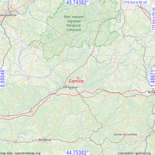
Cornille GPS coordinates[2]
45° 15' 3.528" North, 0° 47' 0.888" East
| Map corner | latitude | longitude |
|---|---|---|
| Upper-left | 45.74382°, | 0.08046° |
| Center: | 45.25098°, | 0.78358° |
| Lower-right: | 44.75382°, | 1.48671° |
| Map W x H: | 110.1×110.1 km | = 68.4×68.4mi |
| max Lat: | 51.07786° ⇑76.9% North |
| Cornille: | 45.25098° |
| min Lat: | ⇓23.1% South 41.3874° |
| min Long | Cornille | max Long |
| -5.08615° | 0.78358° | 9.52242° |
| W 29.3%⇐ | ⇒70.7% E |
Elevation
Elevation of Cornille is 185 m = 607 ft, and this is 8.7 m = 29 ft below average elevation for this country.
| Max E: |
2333 m = 7654 ft | 36.9% |
| Avg. | 193.7 m = 635 ft | |
| Cornille | 185 m = 607 ft | |
Min E: |
-1 m = -3 ft | 63.1% |
See also: France elevation on elevation.city.
Geographical zone
Cornille is located in North temperate zone (between Tropic of Cancer and the Arctic Circle). Distance of this North polar circle is 2369.7 km =1472.5 mi to North.| Distance of | km | miles | from Cornille |
|---|---|---|---|
| North Pole | 4975.6 | 3091.7 | to North |
| Arctic Circle | 2369.7 | 1472.5 | to North |
| Tropic Cancer | 2425.5 | 1507.1 | to South |
| Equator | 5031.4 | 3126.4 | to South |


Nearby cities:
15 places around Cornille: (largest is in red/bold)
• Agonac
5.3 km =3.3 mi,  330°
330°
• Antonne-et-Trigonant
5.6 km =3.5 mi,  139°
139°
• Atur
12.6 km =7.8 mi,  193°
193°
• Bassillac
6.9 km =4.3 mi,  158°
158°
• Champcevinel
5.8 km =3.6 mi,  228°
228°
• Chancelade
10.3 km =6.4 mi,  237°
237°
• Cubjac
12.6 km =7.8 mi,  104°
104°
• Eyliac
11.4 km =7.1 mi,  150°
150°
• Le Change
10.6 km =6.6 mi,  124°
124°
• Négrondes
12.1 km =7.5 mi,  31°
31°
• Périgueux
9.2 km =5.7 mi,  214°
214°
• Saint-Laurent-sur-Manoire
11.4 km =7.1 mi,  175°
175°
• Savignac-les-Églises
10.5 km =6.5 mi,  76°
76°
• Sorges
9.3 km =5.8 mi,  49°
49°
• Trélissac
5.9 km =3.7 mi, 178°
Sources, notices
• [Note1] Compared only with cities in France existing in our database
• [Src1] Map data: © OpenStreetMap contributors (CC-BY-SA)
• [Src2] Other city data from geonames.org with taken over terms of usage.
• [Src3] Geographical zone / Annual Mean Temperature by Robert A. Rohde @ Wikipedia
