Savigny-le-Vieux geodata
Savigny-le-Vieux (Normandy) is a populated place; located in France in Europe/Paris (GMT+2) time zone. With population of 503 people, there are 15179 cities with bigger population in this country. Compared to other cities in France, 68.9% of cities are located further ↓South; 88.6% of cities are located further →East and 53.1% of cities have lower elevation than Savigny-le-Vieux. Note1
Administrative division(s):
- Level 1: Normandy
- Level 2: Manche
- Level 3: Avranches
- Level 4: Savigny-le-Vieux


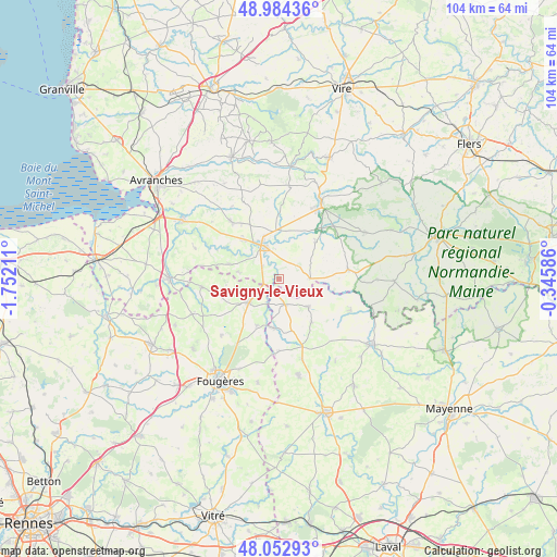
Savigny-le-Vieux GPS coordinates[2]
48° 31' 14.844" North, 1° 2' 56.328" West
| Map corner | latitude | longitude |
|---|---|---|
| Upper-left | 48.98436°, | -1.75211° |
| Center: | 48.52079°, | -1.04898° |
| Lower-right: | 48.05293°, | -0.34586° |
| Map W x H: | 103.6×103.6 km | = 64.4×64.4mi |
| max Lat: | 51.07786° ⇑31.1% North |
| Savigny-le-Vieux: | 48.52079° |
| min Lat: | ⇓68.9% South 41.3874° |
| min Long | Savigny-le-Vieu | max Long |
| -5.08615° | -1.04898° | 9.52242° |
| W 11.4%⇐ | ⇒88.6% E |
Elevation
Elevation of Savigny-le-Vieux is 143 m = 469 ft, and this is 50.7 m = 166 ft below average elevation for this country.
| Max E: |
2333 m = 7654 ft | 46.9% |
| Avg. | 193.7 m = 635 ft | |
| Savigny-le-Vieux | 143 m = 469 ft | |
Min E: |
-1 m = -3 ft | 53.1% |
See also: France elevation on elevation.city.
Geographical zone
Savigny-le-Vieux is located in North temperate zone (between Tropic of Cancer and the Arctic Circle). Distance of this North polar circle is 2006.2 km =1246.6 mi to North.| Distance of | km | miles | from Savigny-le-Vieux |
|---|---|---|---|
| North Pole | 4612.1 | 2865.8 | to North |
| Arctic Circle | 2006.2 | 1246.6 | to North |
| Tropic Cancer | 2789.1 | 1733.1 | to South |
| Equator | 5395 | 3352.3 | to South |


Nearby cities:
15 places around Savigny-le-Vieux: (largest is in red/bold)
• Buais
5.8 km =3.6 mi,  87°
87°
• Fougerolles-du-Plessis
7.6 km =4.7 mi,  132°
132°
• Landivy
4.8 km =3 mi,  166°
166°
• Le Teilleul
13.1 km =8.1 mi,  81°
81°
• Les Loges-Marchis
3.6 km =2.2 mi,  308°
308°
• Louvigné-du-Désert
7.2 km =4.5 mi,  231°
231°
• Mellé
11 km =6.8 mi,  250°
250°
• Notre-Dame-du-Touchet
9.7 km =6 mi,  44°
44°
• Parigny
8.5 km =5.3 mi,  344°
344°
• Pontmain
9.1 km =5.7 mi,  186°
186°
• Saint-Brice-de-Landelles
7.7 km =4.8 mi,  279°
279°
• Saint-Hilaire-du-Harcouët
6.9 km =4.3 mi,  334°
334°
• Saint-Mars-sur-la-Futaie
10.2 km =6.3 mi, 165°
• Saint-Martin-de-Landelles
9.5 km =5.9 mi,  286°
286°
• Virey
9.3 km =5.8 mi,  318°
318°
Sources, notices
• [Note1] Compared only with cities in France existing in our database
• [Src1] Map data: © OpenStreetMap contributors (CC-BY-SA)
• [Src2] Other city data from geonames.org with taken over terms of usage.
• [Src3] Geographical zone / Annual Mean Temperature by Robert A. Rohde @ Wikipedia
