Landivy geodata
Landivy (Pays de la Loire) is a populated place; located in France in Europe/Paris (GMT+2) time zone. With population of 1,344 people, there are 6843 cities with bigger population in this country. Compared to other cities in France, 67.9% of cities are located further ↓South; 88.4% of cities are located further →East and 64.9% of cities have lower elevation than Landivy. Note1
Administrative division(s):
- Level 1: Pays de la Loire
- Level 2: Mayenne
- Level 3: Arrondissement de Mayenne
- Level 4: Landivy


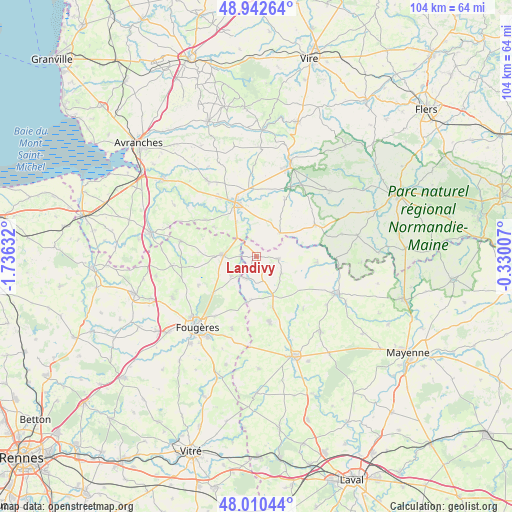
Landivy GPS coordinates[2]
48° 28' 43.248" North, 1° 1' 59.52" West
| Map corner | latitude | longitude |
|---|---|---|
| Upper-left | 48.94264°, | -1.73632° |
| Center: | 48.47868°, | -1.0332° |
| Lower-right: | 48.01044°, | -0.33007° |
| Map W x H: | 103.7×103.6 km | = 64.4×64.4mi |
| max Lat: | 51.07786° ⇑32.1% North |
| Landivy: | 48.47868° |
| min Lat: | ⇓67.9% South 41.3874° |
| min Long | Landivy | max Long |
| -5.08615° | -1.0332° | 9.52242° |
| W 11.6%⇐ | ⇒88.4% E |
Elevation
Elevation of Landivy is 193 m = 633 ft, and this is 0.69999999999999 m = 2 ft below average elevation for this country.
| Max E: |
2333 m = 7654 ft | 35.1% |
| Avg. | 193.7 m = 635 ft | |
| Landivy | 193 m = 633 ft | |
Min E: |
-1 m = -3 ft | 64.9% |
See also: France elevation on elevation.city.
Geographical zone
Landivy is located in North temperate zone (between Tropic of Cancer and the Arctic Circle). Distance of this North polar circle is 2010.9 km =1249.5 mi to North.| Distance of | km | miles | from Landivy |
|---|---|---|---|
| North Pole | 4616.7 | 2868.7 | to North |
| Arctic Circle | 2010.9 | 1249.5 | to North |
| Tropic Cancer | 2784.4 | 1730.1 | to South |
| Equator | 5390.3 | 3349.4 | to South |


Nearby cities:
15 places around Landivy: (largest is in red/bold)
• Buais
6.8 km =4.2 mi,  43°
43°
• Désertines
12.3 km =7.6 mi,  95°
95°
• Fougerolles-du-Plessis
4.5 km =2.8 mi, 96°
• Landéan
11.5 km =7.1 mi,  230°
230°
• Le Loroux
9.7 km =6 mi,  194°
194°
• Les Loges-Marchis
8 km =5 mi,  330°
330°
• Louvigné-du-Désert
6.8 km =4.2 mi,  271°
271°
• Mellé
11.5 km =7.1 mi, 274°
• Montaudin
10.9 km =6.8 mi,  162°
162°
• Pontmain
4.9 km =3 mi,  206°
206°
• Saint-Brice-de-Landelles
10.7 km =6.6 mi,  304°
304°
• Saint-Hilaire-du-Harcouët
11.7 km =7.3 mi,  339°
339°
• Saint-Mars-sur-la-Futaie
5.4 km =3.4 mi,  165°
165°
• Saint-Martin-de-Landelles
12.6 km =7.8 mi,  305°
305°
• Savigny-le-Vieux
4.8 km =3 mi,  346°
346°
Sources, notices
• [Note1] Compared only with cities in France existing in our database
• [Src1] Map data: © OpenStreetMap contributors (CC-BY-SA)
• [Src2] Other city data from geonames.org with taken over terms of usage.
• [Src3] Geographical zone / Annual Mean Temperature by Robert A. Rohde @ Wikipedia
