Saulnot geodata
Saulnot (Bourgogne-Franche-Comté) is a populated place; located in France in Europe/Paris (GMT+2) time zone. With population of 692 people, there are 11913 cities with bigger population in this country. Compared to other cities in France, 52.2% of cities are located further ↓South; 92.5% of cities are located further ←West and 85.8% of cities have lower elevation than Saulnot. Note1
Administrative division(s):
- Level 1: Bourgogne-Franche-Comté
- Level 2: Département de la Haute-Saône
- Level 3: Arrondissement de Lure
- Level 4: Saulnot


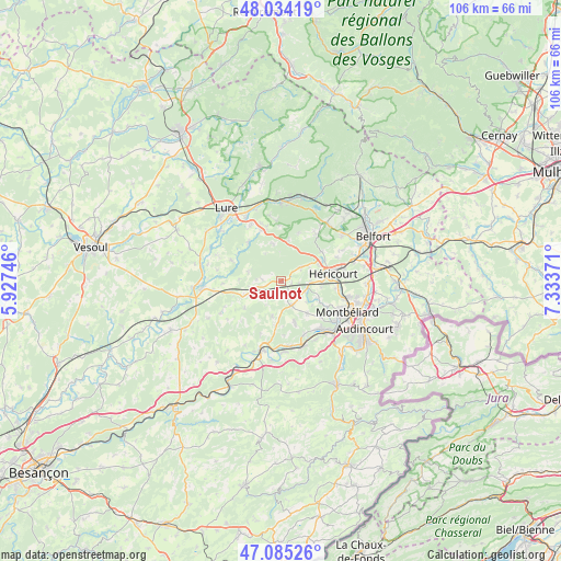
Saulnot GPS coordinates[2]
47° 33' 42.732" North, 6° 37' 50.088" East
| Map corner | latitude | longitude |
|---|---|---|
| Upper-left | 48.03419°, | 5.92746° |
| Center: | 47.56187°, | 6.63058° |
| Lower-right: | 47.08526°, | 7.33371° |
| Map W x H: | 105.5×105.5 km | = 65.6×65.6mi |
| max Lat: | 51.07786° ⇑47.8% North |
| Saulnot: | 47.56187° |
| min Lat: | ⇓52.2% South 41.3874° |
| min Long | Saulnot | max Long |
| -5.08615° | 6.63058° | 9.52242° |
| W 92.5%⇐ | ⇒7.5% E |
Elevation
Elevation of Saulnot is 358 m = 1175 ft, and this is 164.3 m = 539 ft above average elevation for this country.
| Max E: |
2333 m = 7654 ft | 14.2% |
| Saulnot | 358 m 1175 ft | |
| Avg. | 193.7 m = 635 ft | |
Min E: |
-1 m = -3 ft | 85.8% |
See also: France elevation on elevation.city.
Geographical zone
Saulnot is located in North temperate zone (between Tropic of Cancer and the Arctic Circle). Distance of this North polar circle is 2112.8 km =1312.8 mi to North.| Distance of | km | miles | from Saulnot |
|---|---|---|---|
| North Pole | 4718.7 | 2932.1 | to North |
| Arctic Circle | 2112.8 | 1312.8 | to North |
| Tropic Cancer | 2682.5 | 1666.8 | to South |
| Equator | 5288.4 | 3286.1 | to South |


Nearby cities:
15 places around Saulnot: (largest is in red/bold)
• Arcey
5 km =3.1 mi,  151°
151°
• Athesans-Étroitefontaine
9.5 km =5.9 mi,  296°
296°
• Chagey
9.6 km =6 mi,  53°
53°
• Champey
4.5 km =2.8 mi, 54°
• Chenebier
11.3 km =7 mi,  36°
36°
• Couthenans
7.7 km =4.8 mi,  65°
65°
• Dung
11.2 km =7 mi,  125°
125°
• Désandans
4.6 km =2.9 mi, 131°
• Héricourt
9.9 km =6.2 mi,  82°
82°
• Lougres
10.9 km =6.8 mi,  156°
156°
• Luze
9.1 km =5.7 mi,  64°
64°
• Moffans-et-Vacheresse
9.6 km =6 mi,  321°
321°
• Montenois
8.2 km =5.1 mi, 161°
• Présentevillers
10.1 km =6.3 mi, 132°
• Sainte-Marie
7.8 km =4.8 mi,  140°
140°
Sources, notices
• [Note1] Compared only with cities in France existing in our database
• [Src1] Map data: © OpenStreetMap contributors (CC-BY-SA)
• [Src2] Other city data from geonames.org with taken over terms of usage.
• [Src3] Geographical zone / Annual Mean Temperature by Robert A. Rohde @ Wikipedia
