Désandans geodata
Désandans (Bourgogne-Franche-Comté) is a populated place; located in France in Europe/Paris (GMT+2) time zone. With population of 606 people, there are 13224 cities with bigger population in this country. Compared to other cities in France, 51.7% of cities are located further ↓South; 92.9% of cities are located further ←West and 87.5% of cities have lower elevation than Désandans. Note1
Administrative division(s):
- Level 1: Bourgogne-Franche-Comté
- Level 2: Doubs
- Level 3: Arrondissement de Montbéliard
- Level 4: Désandans


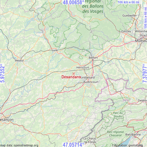
Désandans GPS coordinates[2]
47° 32' 2.436" North, 6° 40' 35.904" East
| Map corner | latitude | longitude |
|---|---|---|
| Upper-left | 48.00658°, | 5.97352° |
| Center: | 47.53401°, | 6.67664° |
| Lower-right: | 47.05714°, | 7.37977° |
| Map W x H: | 105.6×105.6 km | = 65.6×65.6mi |
| max Lat: | 51.07786° ⇑48.3% North |
| Désandans: | 47.53401° |
| min Lat: | ⇓51.7% South 41.3874° |
| min Long | Désandans | max Long |
| -5.08615° | 6.67664° | 9.52242° |
| W 92.9%⇐ | ⇒7.1% E |
Elevation
Elevation of Désandans is 381 m = 1250 ft, and this is 187.3 m = 615 ft above average elevation for this country.
| Max E: |
2333 m = 7654 ft | 12.5% |
| Désandans | 381 m 1250 ft | |
| Avg. | 193.7 m = 635 ft | |
Min E: |
-1 m = -3 ft | 87.5% |
See also: France elevation on elevation.city.
Geographical zone
Désandans is located in North temperate zone (between Tropic of Cancer and the Arctic Circle). Distance of this North polar circle is 2115.9 km =1314.8 mi to North.| Distance of | km | miles | from Désandans |
|---|---|---|---|
| North Pole | 4721.8 | 2934 | to North |
| Arctic Circle | 2115.9 | 1314.8 | to North |
| Tropic Cancer | 2679.4 | 1664.9 | to South |
| Equator | 5285.3 | 3284.1 | to South |


Nearby cities:
15 places around Désandans: (largest is in red/bold)
• Arcey
1.7 km =1.1 mi,  220°
220°
• Bavans
6.9 km =4.3 mi,  141°
141°
• Champey
5.7 km =3.5 mi,  1°
1°
• Couthenans
7.2 km =4.5 mi,  29°
29°
• Dampierre-sur-le-Doubs
7.8 km =4.8 mi,  148°
148°
• Dung
6.6 km =4.1 mi,  121°
121°
• Héricourt
7.7 km =4.8 mi,  55°
55°
• Lougres
7 km =4.3 mi,  173°
173°
• Luze
8.5 km =5.3 mi, 33°
• Montenois
4.7 km =2.9 mi,  190°
190°
• Présentevillers
5.4 km =3.4 mi,  132°
132°
• Sainte-Marie
3.2 km =2 mi, 152°
• Sainte-Suzanne
7.8 km =4.8 mi, 118°
• Saulnot
4.6 km =2.9 mi,  311°
311°
• Étouvans
8.4 km =5.2 mi,  157°
157°
Sources, notices
• [Note1] Compared only with cities in France existing in our database
• [Src1] Map data: © OpenStreetMap contributors (CC-BY-SA)
• [Src2] Other city data from geonames.org with taken over terms of usage.
• [Src3] Geographical zone / Annual Mean Temperature by Robert A. Rohde @ Wikipedia
