Héricourt geodata
Héricourt (Bourgogne-Franche-Comté) is a populated place; located in France in Europe/Paris (GMT+2) time zone. With population of 10,985 people, there are 873 cities with bigger population in this country. Compared to other cities in France, 52.3% of cities are located further ↓South; 93.4% of cities are located further ←West and 83.6% of cities have lower elevation than Héricourt. Note1
Administrative division(s):
- Level 1: Bourgogne-Franche-Comté
- Level 2: Département de la Haute-Saône
- Level 3: Arrondissement de Lure
- Level 4: Héricourt


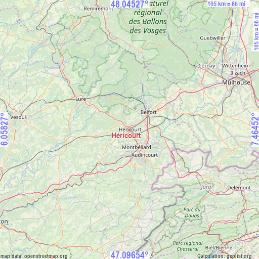
Héricourt GPS coordinates[2]
47° 34' 22.98" North, 6° 45' 41.004" East
| Map corner | latitude | longitude |
|---|---|---|
| Upper-left | 48.04527°, | 6.05827° |
| Center: | 47.57305°, | 6.76139° |
| Lower-right: | 47.09654°, | 7.46452° |
| Map W x H: | 105.5×105.5 km | = 65.6×65.6mi |
| max Lat: | 51.07786° ⇑47.7% North |
| Héricourt: | 47.57305° |
| min Lat: | ⇓52.3% South 41.3874° |
| min Long | Héricourt | max Long |
| -5.08615° | 6.76139° | 9.52242° |
| W 93.4%⇐ | ⇒6.6% E |
Elevation
Elevation of Héricourt is 329 m = 1079 ft, and this is 135.3 m = 444 ft above average elevation for this country.
| Max E: |
2333 m = 7654 ft | 16.4% |
| Héricourt | 329 m 1079 ft | |
| Avg. | 193.7 m = 635 ft | |
Min E: |
-1 m = -3 ft | 83.6% |
See also: France elevation on elevation.city.
Geographical zone
Héricourt is located in North temperate zone (between Tropic of Cancer and the Arctic Circle). Distance of this North polar circle is 2111.5 km =1312 mi to North.| Distance of | km | miles | from Héricourt |
|---|---|---|---|
| North Pole | 4717.4 | 2931.3 | to North |
| Arctic Circle | 2111.5 | 1312 | to North |
| Tropic Cancer | 2683.7 | 1667.6 | to South |
| Equator | 5289.6 | 3286.8 | to South |


Nearby cities:
15 places around Héricourt: (largest is in red/bold)
• Bavilliers
7.8 km =4.8 mi,  45°
45°
• Bethoncourt
5.3 km =3.3 mi,  142°
142°
• Brevilliers
2.4 km =1.5 mi,  64°
64°
• Chagey
4.9 km =3 mi,  334°
334°
• Champey
6.3 km =3.9 mi,  282°
282°
• Châlonvillars
7.7 km =4.8 mi,  12°
12°
• Châtenois-les-Forges
6.7 km =4.2 mi,  103°
103°
• Couthenans
3.4 km =2.1 mi,  305°
305°
• Dorans
6 km =3.7 mi,  73°
73°
• Dung
7.8 km =4.8 mi,  185°
185°
• Désandans
7.7 km =4.8 mi,  235°
235°
• Grand-Charmont
7.1 km =4.4 mi, 136°
• Luze
3.1 km =1.9 mi, 328°
• Montbéliard
7.6 km =4.7 mi,  158°
158°
• Nommay
7.2 km =4.5 mi,  122°
122°
Sources, notices
• [Note1] Compared only with cities in France existing in our database
• [Src1] Map data: © OpenStreetMap contributors (CC-BY-SA)
• [Src2] Other city data from geonames.org with taken over terms of usage.
• [Src3] Geographical zone / Annual Mean Temperature by Robert A. Rohde @ Wikipedia
