Athesans-Étroitefontaine geodata
Athesans-Étroitefontaine (Bourgogne-Franche-Comté) is a populated place; located in France in Europe/Paris (GMT+2) time zone. With population of 643 people, there are 12632 cities with bigger population in this country. Compared to other cities in France, 52.6% of cities are located further ↓South; 91.8% of cities are located further ←West and 81.2% of cities have lower elevation than Athesans-Étroitefontaine. Note1
Administrative division(s):
- Level 1: Bourgogne-Franche-Comté
- Level 2: Département de la Haute-Saône
- Level 3: Arrondissement de Lure
- Level 4: Athesans-Étroitefontaine
Current local time in Athesans-Étroitefontaine:
01:14 PM, SaturdayDifference from your time zone: hours


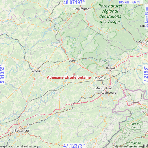
Athesans-Étroitefontaine GPS coordinates[2]
47° 36' 0" North, 6° 31' 0.012" East
| Map corner | latitude | longitude |
|---|---|---|
| Upper-left | 48.07197°, | 5.81355° |
| Center: | 47.6°, | 6.51667° |
| Lower-right: | 47.12373°, | 7.2198° |
| Map W x H: | 105.4×105.4 km | = 65.5×65.5mi |
| max Lat: | 51.07786° ⇑47.4% North |
| Athesans-Étroitefontaine: | 47.6° |
| min Lat: | ⇓52.6% South 41.3874° |
| min Long | Athesans-Étroi | max Long |
| -5.08615° | 6.51667° | 9.52242° |
| W 91.8%⇐ | ⇒8.2% E |
Elevation
Elevation of Athesans-Étroitefontaine is 302 m = 991 ft, and this is 108.3 m = 355 ft above average elevation for this country.
| Max E: |
2333 m = 7654 ft | 18.8% |
| Athesans-Étroitefontaine | 302 m 991 ft | |
| Avg. | 193.7 m = 635 ft | |
Min E: |
-1 m = -3 ft | 81.2% |
See also: France elevation on elevation.city.
Geographical zone
Athesans-Étroitefontaine is located in North temperate zone (between Tropic of Cancer and the Arctic Circle). Distance of this North polar circle is 2108.6 km =1310.2 mi to North.| Distance of | km | miles | from Athesans-Étroitefontaine |
|---|---|---|---|
| North Pole | 4714.4 | 2929.4 | to North |
| Arctic Circle | 2108.6 | 1310.2 | to North |
| Tropic Cancer | 2686.7 | 1669.4 | to South |
| Equator | 5292.6 | 3288.7 | to South |


Nearby cities:
15 places around Athesans-Étroitefontaine: (largest is in red/bold)
• Arcey
13.9 km =8.6 mi,  128°
128°
• Champey
12.3 km =7.6 mi,  97°
97°
• Désandans
14.1 km =8.8 mi,  121°
121°
• Esprels
12.9 km =8 mi,  236°
236°
• Frotey-lès-Lure
6.7 km =4.2 mi,  23°
23°
• La Côte
10.5 km =6.5 mi, 23°
• Lure
9.3 km =5.8 mi,  350°
350°
• Magny-Vernois
8.4 km =5.2 mi,  338°
338°
• Moffans-et-Vacheresse
4.2 km =2.6 mi,  38°
38°
• Ronchamp
14.3 km =8.9 mi, 38°
• Roye
8 km =5 mi,  13°
13°
• Saint-Germain
13.9 km =8.6 mi,  4°
4°
• Saulnot
9.5 km =5.9 mi, 116°
• Villersexel
8.3 km =5.2 mi,  228°
228°
• Vy-lès-Lure
7.4 km =4.6 mi,  313°
313°
Sources, notices
• [Note1] Compared only with cities in France existing in our database
• [Src1] Map data: © OpenStreetMap contributors (CC-BY-SA)
• [Src2] Other city data from geonames.org with taken over terms of usage.
• [Src3] Geographical zone / Annual Mean Temperature by Robert A. Rohde @ Wikipedia
