San-Nicolao geodata
San-Nicolao (Corsica) is a populated place; located in France in Europe/Paris (GMT+2) time zone. With population of 1,462 people, there are 6325 cities with bigger population in this country. Compared to other cities in France, 99.7% of cities are located further ↑North; 100% of cities are located further ←West and 93.9% of cities have higher elevation than San-Nicolao. Note1
Administrative division(s):
- Level 1: Corsica
- Level 2: Département de la Haute-Corse
- Level 3: Arrondissement de Corte
- Level 4: San-Nicolao


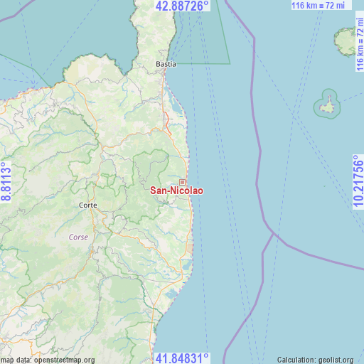
San-Nicolao GPS coordinates[2]
42° 22' 11.748" North, 9° 30' 51.948" East
| Map corner | latitude | longitude |
|---|---|---|
| Upper-left | 42.88726°, | 8.8113° |
| Center: | 42.36993°, | 9.51443° |
| Lower-right: | 41.84831°, | 10.21756° |
| Map W x H: | 115.5×115.5 km | = 71.8×71.8mi |
| max Lat: | 51.07786° ⇑99.7% North |
| San-Nicolao: | 42.36993° |
| min Lat: | ⇓0.3% South 41.3874° |
| min Long | San-Nicolao | max Long |
| -5.08615° | 9.51443° | 9.52242° |
| W 100%⇐ | ⇒0% E |
Elevation
Elevation of San-Nicolao is 20 m = 66 ft, and this is 173.7 m = 570 ft below average elevation for this country.
| Max E: |
2333 m = 7654 ft | 93.9% |
| Avg. | 193.7 m = 635 ft | |
| San-Nicolao | 20 m = 66 ft | |
Min E: |
-1 m = -3 ft | 6.1% |
See also: France elevation on elevation.city.
Geographical zone
San-Nicolao is located in North temperate zone (between Tropic of Cancer and the Arctic Circle). Distance of this Northern Tropic circle is 2105.2 km =1308.1 mi to South.| Distance of | km | miles | from San-Nicolao |
|---|---|---|---|
| North Pole | 5296 | 3290.8 | to North |
| Arctic Circle | 2690.1 | 1671.6 | to North |
| Tropic Cancer | 2105.2 | 1308.1 | to South |
| Equator | 4711.1 | 2927.3 | to South |


Nearby cities:
15 places around San-Nicolao: (largest is in red/bold)
• Borgo
21.8 km =13.5 mi,  340°
340°
• Castellare-di-Casinca
11.4 km =7.1 mi, 343°
• Cervione
4.9 km =3 mi,  200°
200°
• Linguizzetta
12.3 km =7.6 mi, 196°
• Lucciana
21.1 km =13.1 mi, 338°
• Morosaglia
19 km =11.8 mi,  292°
292°
• Penta-di-Casinca
11.6 km =7.2 mi, 336°
• San-Giuliano
6.4 km =4 mi,  178°
178°
• Santa-Lucia-di-Moriani
1.5 km =0.9 mi,  25°
25°
• Santa-Maria-Poggio
3.2 km =2 mi,  209°
209°
• Sorbo-Ocagnano
12.8 km =8 mi, 337°
• Taglio
8.1 km =5 mi,  333°
333°
• Talasani
5.2 km =3.2 mi, 326°
• Vescovato
15 km =9.3 mi, 335°
• Vignale
19.1 km =11.9 mi,  305°
305°
Sources, notices
• [Note1] Compared only with cities in France existing in our database
• [Src1] Map data: © OpenStreetMap contributors (CC-BY-SA)
• [Src2] Other city data from geonames.org with taken over terms of usage.
• [Src3] Geographical zone / Annual Mean Temperature by Robert A. Rohde @ Wikipedia
