Sancoins geodata
Sancoins (Centre) is a populated place; located in France in Europe/Paris (GMT+2) time zone. With population of 3,576 people, there are 2726 cities with bigger population in this country. Compared to other cities in France, 56.8% of cities are located further ↑North; 56.7% of cities are located further ←West and 66.1% of cities have lower elevation than Sancoins. Note1
Administrative division(s):
- Level 1: Centre
- Level 2: Cher
- Level 3: Arrondissement de Saint-Amand-Montrond
- Level 4: Sancoins


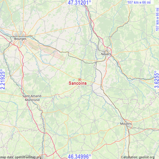
Sancoins GPS coordinates[2]
46° 49' 59.304" North, 2° 55' 20.568" East
| Map corner | latitude | longitude |
|---|---|---|
| Upper-left | 47.31201°, | 2.21925° |
| Center: | 46.83314°, | 2.92238° |
| Lower-right: | 46.34996°, | 3.6255° |
| Map W x H: | 107×107 km | = 66.5×66.5mi |
| max Lat: | 51.07786° ⇑56.8% North |
| Sancoins: | 46.83314° |
| min Lat: | ⇓43.2% South 41.3874° |
| min Long | Sancoins | max Long |
| -5.08615° | 2.92238° | 9.52242° |
| W 56.7%⇐ | ⇒43.3% E |
Elevation
Elevation of Sancoins is 199 m = 653 ft, and this is 5.3 m = 17 ft above average elevation for this country.
| Max E: |
2333 m = 7654 ft | 33.9% |
| Sancoins | 199 m 653 ft | |
| Avg. | 193.7 m = 635 ft | |
Min E: |
-1 m = -3 ft | 66.1% |
See also: France elevation on elevation.city.
Geographical zone
Sancoins is located in North temperate zone (between Tropic of Cancer and the Arctic Circle). Distance of this North polar circle is 2193.8 km =1363.2 mi to North.| Distance of | km | miles | from Sancoins |
|---|---|---|---|
| North Pole | 4799.7 | 2982.4 | to North |
| Arctic Circle | 2193.8 | 1363.2 | to North |
| Tropic Cancer | 2601.4 | 1616.4 | to South |
| Equator | 5207.4 | 3235.7 | to South |


Nearby cities:
15 places around Sancoins: (largest is in red/bold)
• Blet
16 km =9.9 mi,  295°
295°
• Challuy
21.5 km =13.4 mi,  52°
52°
• Couleuvre
17.9 km =11.1 mi,  183°
183°
• Cuffy
17.5 km =10.9 mi,  34°
34°
• Gimouille
17.4 km =10.8 mi, 45°
• Le Veurdre
12.4 km =7.7 mi,  133°
133°
• Livry
13.2 km =8.2 mi,  118°
118°
• Lurcy-Lévis
11.6 km =7.2 mi,  173°
173°
• Magny-Cours
18.2 km =11.3 mi,  72°
72°
• Marzy
21 km =13 mi,  38°
38°
• Nérondes
19.9 km =12.4 mi,  336°
336°
• Ourouer-les-Bourdelins
12.3 km =7.6 mi,  319°
319°
• Saint-Parize-le-Châtel
19.9 km =12.4 mi,  83°
83°
• Saint-Pierre-le-Moûtier
15.4 km =9.6 mi,  106°
106°
• Torteron
21.4 km =13.3 mi,  8°
8°
Sources, notices
• [Note1] Compared only with cities in France existing in our database
• [Src1] Map data: © OpenStreetMap contributors (CC-BY-SA)
• [Src2] Other city data from geonames.org with taken over terms of usage.
• [Src3] Geographical zone / Annual Mean Temperature by Robert A. Rohde @ Wikipedia
