Salaise-sur-Sanne geodata
Salaise-sur-Sanne (Auvergne-Rhône-Alpes) is a populated place; located in France in Europe/Paris (GMT+2) time zone. With population of 3,981 people, there are 2472 cities with bigger population in this country. Compared to other cities in France, 75.8% of cities are located further ↑North; 75.2% of cities are located further ←West and 63.6% of cities have lower elevation than Salaise-sur-Sanne. Note1
Administrative division(s):
- Level 1: Auvergne-Rhône-Alpes
- Level 2: Département de l'Isère
- Level 3: Arrondissement de Vienne
- Level 4: Salaise-sur-Sanne


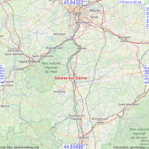
Salaise-sur-Sanne GPS coordinates[2]
45° 21' 4.536" North, 4° 48' 38.52" East
| Map corner | latitude | longitude |
|---|---|---|
| Upper-left | 45.84323°, | 4.10757° |
| Center: | 45.35126°, | 4.8107° |
| Lower-right: | 44.85498°, | 5.51382° |
| Map W x H: | 109.9×109.9 km | = 68.3×68.3mi |
| max Lat: | 51.07786° ⇑75.8% North |
| Salaise-sur-Sanne: | 45.35126° |
| min Lat: | ⇓24.2% South 41.3874° |
| min Long | Salaise-sur-San | max Long |
| -5.08615° | 4.8107° | 9.52242° |
| W 75.2%⇐ | ⇒24.8% E |
Elevation
Elevation of Salaise-sur-Sanne is 187 m = 614 ft, and this is 6.7 m = 22 ft below average elevation for this country.
| Max E: |
2333 m = 7654 ft | 36.4% |
| Avg. | 193.7 m = 635 ft | |
| Salaise-sur-Sanne | 187 m = 614 ft | |
Min E: |
-1 m = -3 ft | 63.6% |
See also: France elevation on elevation.city.
Geographical zone
Salaise-sur-Sanne is located in North temperate zone (between Tropic of Cancer and the Arctic Circle). Distance of this North polar circle is 2358.6 km =1465.6 mi to North.| Distance of | km | miles | from Salaise-sur-Sanne |
|---|---|---|---|
| North Pole | 4964.5 | 3084.8 | to North |
| Arctic Circle | 2358.6 | 1465.6 | to North |
| Tropic Cancer | 2436.7 | 1514.1 | to South |
| Equator | 5042.6 | 3133.3 | to South |


Nearby cities:
15 places around Salaise-sur-Sanne: (largest is in red/bold)
• Agnin
3.5 km =2.2 mi,  110°
110°
• Anjou
5.8 km =3.6 mi,  92°
92°
• Assieu
7.1 km =4.4 mi,  32°
32°
• Bougé-Chambalud
7.3 km =4.5 mi, 108°
• Chanas
3.7 km =2.3 mi,  170°
170°
• Charnas
5.5 km =3.4 mi,  252°
252°
• Clonas-sur-Varèze
7.1 km =4.4 mi,  347°
347°
• Le Péage-de-Roussillon
2.7 km =1.7 mi,  337°
337°
• Limony
4.1 km =2.5 mi,  271°
271°
• Roussillon
2.5 km =1.6 mi,  7°
7°
• Sablons
4.4 km =2.7 mi,  220°
220°
• Saint-Pierre-de-Bœuf
5 km =3.1 mi,  289°
289°
• Serrières
5.2 km =3.2 mi,  225°
225°
• Sonnay
7.4 km =4.6 mi,  84°
84°
• Ville-sous-Anjou
3.9 km =2.4 mi,  52°
52°
Sources, notices
• [Note1] Compared only with cities in France existing in our database
• [Src1] Map data: © OpenStreetMap contributors (CC-BY-SA)
• [Src2] Other city data from geonames.org with taken over terms of usage.
• [Src3] Geographical zone / Annual Mean Temperature by Robert A. Rohde @ Wikipedia
