Saint-Sulpice-de-Faleyrens geodata
Saint-Sulpice-de-Faleyrens (Nouvelle-Aquitaine) is a populated place; located in France in Europe/Paris (GMT+2) time zone. With population of 1,789 people, there are 5306 cities with bigger population in this country. Compared to other cities in France, 80.8% of cities are located further ↑North; 79.5% of cities are located further →East and 98.2% of cities have higher elevation than Saint-Sulpice-de-Faleyrens. Note1
Administrative division(s):
- Level 1: Nouvelle-Aquitaine
- Level 2: Gironde
- Level 3: Arrondissement de Libourne
- Level 4: Saint-Sulpice-de-Faleyrens
Current local time in Saint-Sulpice-de-Faleyrens:
05:56 AM, WednesdayDifference from your time zone: hours


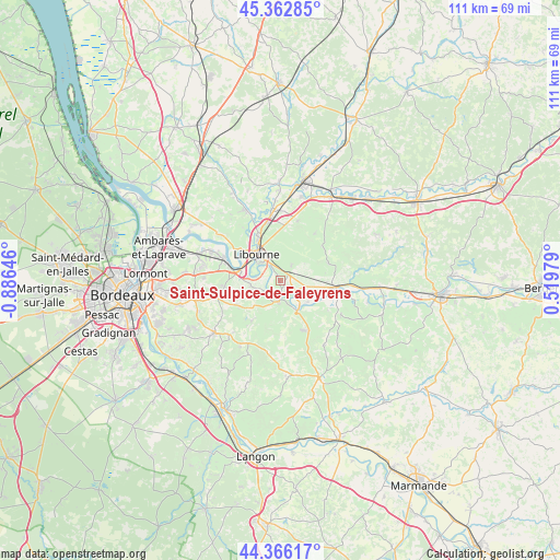
Saint-Sulpice-de-Faleyrens GPS coordinates[2]
44° 52' 0.012" North, 0° 10' 59.988" West
| Map corner | latitude | longitude |
|---|---|---|
| Upper-left | 45.36285°, | -0.88646° |
| Center: | 44.86667°, | -0.18333° |
| Lower-right: | 44.36617°, | 0.51979° |
| Map W x H: | 110.8×110.8 km | = 68.8×68.8mi |
| max Lat: | 51.07786° ⇑80.8% North |
| Saint-Sulpice-de-Faleyrens: | 44.86667° |
| min Lat: | ⇓19.2% South 41.3874° |
| min Long | Saint-Sulpice-d | max Long |
| -5.08615° | -0.18333° | 9.52242° |
| W 20.5%⇐ | ⇒79.5% E |
Elevation
Elevation of Saint-Sulpice-de-Faleyrens is 8 m = 26 ft, and this is 185.7 m = 609 ft below average elevation for this country.
| Max E: |
2333 m = 7654 ft | 98.2% |
| Avg. | 193.7 m = 635 ft | |
| Saint-Sulpice-de-Faleyrens | 8 m = 26 ft | |
Min E: |
-1 m = -3 ft | 1.8% |
See also: France elevation on elevation.city.
Geographical zone
Saint-Sulpice-de-Faleyrens is located in North temperate zone (between Tropic of Cancer and the Arctic Circle). Distance of this Northern Tropic circle is 2382.8 km =1480.6 mi to South.| Distance of | km | miles | from Saint-Sulpice-de-Faleyrens |
|---|---|---|---|
| North Pole | 5018.4 | 3118.3 | to North |
| Arctic Circle | 2412.5 | 1499.1 | to North |
| Tropic Cancer | 2382.8 | 1480.6 | to South |
| Equator | 4988.7 | 3099.8 | to South |


Nearby cities:
15 places around Saint-Sulpice-de-Faleyrens: (largest is in red/bold)
• Arveyres
8.1 km =5 mi,  283°
283°
• Branne
3.7 km =2.3 mi,  180°
180°
• Fronsac
8.6 km =5.3 mi,  310°
310°
• Grézillac
6 km =3.7 mi,  205°
205°
• Génissac
5.6 km =3.5 mi,  250°
250°
• Libourne
7.2 km =4.5 mi,  318°
318°
• Montagne
8.4 km =5.2 mi,  27°
27°
• Moulon
3.2 km =2 mi,  234°
234°
• Naujan-et-Postiac
8.6 km =5.3 mi, 178°
• Nérigean
8.7 km =5.4 mi,  244°
244°
• Pomerol
7.5 km =4.7 mi,  349°
349°
• Saint-Christophe-des-Bardes
6.8 km =4.2 mi,  74°
74°
• Saint-Émilion
3.2 km =2 mi,  54°
54°
• Sainte-Terre
6.4 km =4 mi,  125°
125°
• Vignonet
2.3 km =1.4 mi,  144°
144°
Sources, notices
• [Note1] Compared only with cities in France existing in our database
• [Src1] Map data: © OpenStreetMap contributors (CC-BY-SA)
• [Src2] Other city data from geonames.org with taken over terms of usage.
• [Src3] Geographical zone / Annual Mean Temperature by Robert A. Rohde @ Wikipedia
