Vignonet geodata
Vignonet (Nouvelle-Aquitaine) is a populated place; located in France in Europe/Paris (GMT+2) time zone. With population of 511 people, there are 15016 cities with bigger population in this country. Compared to other cities in France, 81% of cities are located further ↑North; 79.4% of cities are located further →East and 99.3% of cities have higher elevation than Vignonet. Note1
Administrative division(s):
- Level 1: Nouvelle-Aquitaine
- Level 2: Gironde
- Level 3: Arrondissement de Libourne
- Level 4: Vignonet


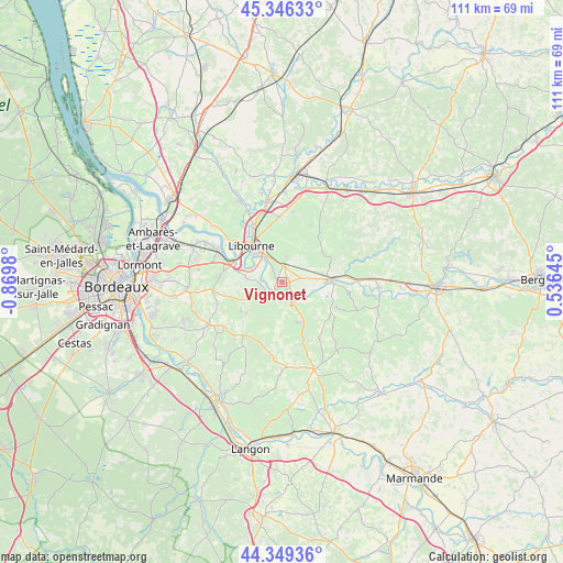
Vignonet GPS coordinates[2]
44° 51' 0" North, 0° 10' 0.012" West
| Map corner | latitude | longitude |
|---|---|---|
| Upper-left | 45.34633°, | -0.8698° |
| Center: | 44.85°, | -0.16667° |
| Lower-right: | 44.34936°, | 0.53645° |
| Map W x H: | 110.9×110.9 km | = 68.9×68.9mi |
| max Lat: | 51.07786° ⇑81% North |
| Vignonet: | 44.85° |
| min Lat: | ⇓19% South 41.3874° |
| min Long | Vignonet | max Long |
| -5.08615° | -0.16667° | 9.52242° |
| W 20.6%⇐ | ⇒79.4% E |
Elevation
Elevation of Vignonet is 5 m = 16 ft, and this is 188.7 m = 619 ft below average elevation for this country.
| Max E: |
2333 m = 7654 ft | 99.3% |
| Avg. | 193.7 m = 635 ft | |
| Vignonet | 5 m = 16 ft | |
Min E: |
-1 m = -3 ft | 0.7% |
See also: France elevation on elevation.city.
Geographical zone
Vignonet is located in North temperate zone (between Tropic of Cancer and the Arctic Circle). Distance of this Northern Tropic circle is 2380.9 km =1479.4 mi to South.| Distance of | km | miles | from Vignonet |
|---|---|---|---|
| North Pole | 5020.2 | 3119.4 | to North |
| Arctic Circle | 2414.3 | 1500.2 | to North |
| Tropic Cancer | 2380.9 | 1479.4 | to South |
| Equator | 4986.9 | 3098.7 | to South |


Nearby cities:
15 places around Vignonet: (largest is in red/bold)
• Branne
2.3 km =1.4 mi,  215°
215°
• Espiet
9.1 km =5.7 mi,  235°
235°
• Grézillac
5.3 km =3.3 mi,  227°
227°
• Génissac
6.6 km =4.1 mi,  270°
270°
• Libourne
9.5 km =5.9 mi,  320°
320°
• Montagne
9.6 km =6 mi,  15°
15°
• Moulon
3.9 km =2.4 mi, 270°
• Naujan-et-Postiac
6.9 km =4.3 mi,  189°
189°
• Nérigean
9.4 km =5.8 mi,  258°
258°
• Rauzan
8.6 km =5.3 mi,  157°
157°
• Saint-Christophe-des-Bardes
6.4 km =4 mi,  54°
54°
• Saint-Pey-de-Castets
8.9 km =5.5 mi,  118°
118°
• Saint-Sulpice-de-Faleyrens
2.3 km =1.4 mi, 324°
• Saint-Émilion
3.9 km =2.4 mi, 19°
• Sainte-Terre
4.4 km =2.7 mi, 115°
Sources, notices
• [Note1] Compared only with cities in France existing in our database
• [Src1] Map data: © OpenStreetMap contributors (CC-BY-SA)
• [Src2] Other city data from geonames.org with taken over terms of usage.
• [Src3] Geographical zone / Annual Mean Temperature by Robert A. Rohde @ Wikipedia
