Saint-Seurin-de-Cadourne geodata
Saint-Seurin-de-Cadourne (Nouvelle-Aquitaine) is a populated place; located in France in Europe/Paris (GMT+2) time zone. With population of 835 people, there are 10242 cities with bigger population in this country. Compared to other cities in France, 76.5% of cities are located further ↑North; 86.3% of cities are located further →East and 93.9% of cities have higher elevation than Saint-Seurin-de-Cadourne. Note1
Administrative division(s):
- Level 1: Nouvelle-Aquitaine
- Level 2: Gironde
- Level 3: Arrondissement de Lesparre-Médoc
- Level 4: Saint-Seurin-de-Cadourne
Current local time in Saint-Seurin-de-Cadourne:
05:21 PM, SaturdayDifference from your time zone: hours


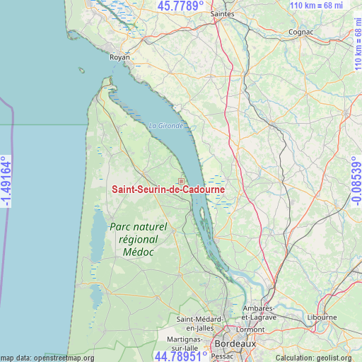
Saint-Seurin-de-Cadourne GPS coordinates[2]
45° 17' 10.896" North, 0° 47' 18.636" West
| Map corner | latitude | longitude |
|---|---|---|
| Upper-left | 45.7789°, | -1.49164° |
| Center: | 45.28636°, | -0.78851° |
| Lower-right: | 44.78951°, | -0.08539° |
| Map W x H: | 110×110 km | = 68.4×68.4mi |
| max Lat: | 51.07786° ⇑76.5% North |
| Saint-Seurin-de-Cadourne: | 45.28636° |
| min Lat: | ⇓23.5% South 41.3874° |
| min Long | Saint-Seurin-de | max Long |
| -5.08615° | -0.78851° | 9.52242° |
| W 13.7%⇐ | ⇒86.3% E |
Elevation
Elevation of Saint-Seurin-de-Cadourne is 20 m = 66 ft, and this is 173.7 m = 570 ft below average elevation for this country.
| Max E: |
2333 m = 7654 ft | 93.9% |
| Avg. | 193.7 m = 635 ft | |
| Saint-Seurin-de-Cadourne | 20 m = 66 ft | |
Min E: |
-1 m = -3 ft | 6.1% |
See also: France elevation on elevation.city.
Geographical zone
Saint-Seurin-de-Cadourne is located in North temperate zone (between Tropic of Cancer and the Arctic Circle). Distance of this North polar circle is 2365.8 km =1470 mi to North.| Distance of | km | miles | from Saint-Seurin-de-Cadourne |
|---|---|---|---|
| North Pole | 4971.7 | 3089.3 | to North |
| Arctic Circle | 2365.8 | 1470 | to North |
| Tropic Cancer | 2429.5 | 1509.6 | to South |
| Equator | 5035.4 | 3128.9 | to South |


Nearby cities:
15 places around Saint-Seurin-de-Cadourne: (largest is in red/bold)
• Anglade
14.8 km =9.2 mi,  125°
125°
• Braud-et-Saint-Louis
13.6 km =8.5 mi,  108°
108°
• Bégadan
11.2 km =7 mi,  312°
312°
• Eyrans
17.3 km =10.7 mi, 129°
• Gaillan-en-Médoc
13.8 km =8.6 mi,  286°
286°
• Lesparre-Médoc
11.9 km =7.4 mi,  281°
281°
• Pauillac
10.5 km =6.5 mi,  162°
162°
• Saint-Androny
15.4 km =9.6 mi, 134°
• Saint-Bonnet-sur-Gironde
12.6 km =7.8 mi,  52°
52°
• Saint-Ciers-sur-Gironde
14.1 km =8.8 mi,  89°
89°
• Saint-Dizant-du-Gua
17.6 km =10.9 mi,  22°
22°
• Saint-Estèphe
2.9 km =1.8 mi,  154°
154°
• Saint-Julien-Beychevelle
13.8 km =8.6 mi, 164°
• Saint-Sauveur
10 km =6.2 mi,  201°
201°
• Vertheuil
5.4 km =3.4 mi,  220°
220°
Sources, notices
• [Note1] Compared only with cities in France existing in our database
• [Src1] Map data: © OpenStreetMap contributors (CC-BY-SA)
• [Src2] Other city data from geonames.org with taken over terms of usage.
• [Src3] Geographical zone / Annual Mean Temperature by Robert A. Rohde @ Wikipedia
