Saint-Ciers-sur-Gironde geodata
Saint-Ciers-sur-Gironde (Nouvelle-Aquitaine) is a populated place; located in France in Europe/Paris (GMT+2) time zone. With population of 3,365 people, there are 2891 cities with bigger population in this country. Compared to other cities in France, 76.5% of cities are located further ↑North; 84.6% of cities are located further →East and 91.2% of cities have higher elevation than Saint-Ciers-sur-Gironde. Note1
Administrative division(s):
- Level 1: Nouvelle-Aquitaine
- Level 2: Gironde
- Level 3: Arrondissement de Blaye
- Level 4: Saint-Ciers-sur-Gironde
Current local time in Saint-Ciers-sur-Gironde:
03:41 PM, SaturdayDifference from your time zone: hours


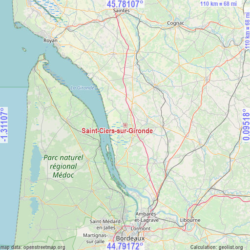
Saint-Ciers-sur-Gironde GPS coordinates[2]
45° 17' 18.78" North, 0° 36' 28.584" West
| Map corner | latitude | longitude |
|---|---|---|
| Upper-left | 45.78107°, | -1.31107° |
| Center: | 45.28855°, | -0.60794° |
| Lower-right: | 44.79172°, | 0.09518° |
| Map W x H: | 110×110 km | = 68.4×68.4mi |
| max Lat: | 51.07786° ⇑76.5% North |
| Saint-Ciers-sur-Gironde: | 45.28855° |
| min Lat: | ⇓23.5% South 41.3874° |
| min Long | Saint-Ciers-sur | max Long |
| -5.08615° | -0.60794° | 9.52242° |
| W 15.4%⇐ | ⇒84.6% E |
Elevation
Elevation of Saint-Ciers-sur-Gironde is 27 m = 89 ft, and this is 166.7 m = 547 ft below average elevation for this country.
| Max E: |
2333 m = 7654 ft | 91.2% |
| Avg. | 193.7 m = 635 ft | |
| Saint-Ciers-sur-Gironde | 27 m = 89 ft | |
Min E: |
-1 m = -3 ft | 8.8% |
See also: France elevation on elevation.city.
Geographical zone
Saint-Ciers-sur-Gironde is located in North temperate zone (between Tropic of Cancer and the Arctic Circle). Distance of this North polar circle is 2365.6 km =1469.9 mi to North.| Distance of | km | miles | from Saint-Ciers-sur-Gironde |
|---|---|---|---|
| North Pole | 4971.4 | 3089.1 | to North |
| Arctic Circle | 2365.6 | 1469.9 | to North |
| Tropic Cancer | 2429.7 | 1509.7 | to South |
| Equator | 5035.6 | 3129 | to South |


Nearby cities:
15 places around Saint-Ciers-sur-Gironde: (largest is in red/bold)
• Anglade
9.1 km =5.7 mi,  193°
193°
• Boisredon
6.2 km =3.9 mi,  61°
61°
• Braud-et-Saint-Louis
4.8 km =3 mi,  195°
195°
• Cartelègue
11.7 km =7.3 mi,  169°
169°
• Donnezac
13.7 km =8.5 mi,  110°
110°
• Eyrans
11.2 km =7 mi,  183°
183°
• Générac
12.9 km =8 mi,  158°
158°
• Marcillac
6.9 km =4.3 mi, 108°
• Mirambeau
9.8 km =6.1 mi,  17°
17°
• Reignac
10 km =6.2 mi,  127°
127°
• Saint-Androny
11.5 km =7.1 mi, 196°
• Saint-Aubin-de-Blaye
4.4 km =2.7 mi,  122°
122°
• Saint-Bonnet-sur-Gironde
8.4 km =5.2 mi,  331°
331°
• Saint-Estèphe
13.2 km =8.2 mi,  257°
257°
• Étauliers
7.5 km =4.7 mi, 158°
Sources, notices
• [Note1] Compared only with cities in France existing in our database
• [Src1] Map data: © OpenStreetMap contributors (CC-BY-SA)
• [Src2] Other city data from geonames.org with taken over terms of usage.
• [Src3] Geographical zone / Annual Mean Temperature by Robert A. Rohde @ Wikipedia
