Saint-Sandoux geodata
Saint-Sandoux (Auvergne-Rhône-Alpes) is a populated place; located in France in Europe/Paris (GMT+2) time zone. With population of 633 people, there are 12771 cities with bigger population in this country. Compared to other cities in France, 71.9% of cities are located further ↑North; 59.4% of cities are located further ←West and 95.5% of cities have lower elevation than Saint-Sandoux. Note1
Administrative division(s):
- Level 1: Auvergne-Rhône-Alpes
- Level 2: Département du Puy-de-Dôme
- Level 3: Arrondissement de Clermont-Ferrand
- Level 4: Saint-Sandoux


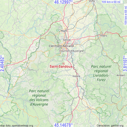
Saint-Sandoux GPS coordinates[2]
45° 38' 25.908" North, 3° 6' 28.62" East
| Map corner | latitude | longitude |
|---|---|---|
| Upper-left | 46.12997°, | 2.40482° |
| Center: | 45.64053°, | 3.10795° |
| Lower-right: | 45.14678°, | 3.81107° |
| Map W x H: | 109.3×109.3 km | = 67.9×67.9mi |
| max Lat: | 51.07786° ⇑71.9% North |
| Saint-Sandoux: | 45.64053° |
| min Lat: | ⇓28.1% South 41.3874° |
| min Long | Saint-Sandoux | max Long |
| -5.08615° | 3.10795° | 9.52242° |
| W 59.4%⇐ | ⇒40.6% E |
Elevation
Elevation of Saint-Sandoux is 612 m = 2008 ft, and this is 418.3 m = 1372 ft above average elevation for this country.
| Max E: |
2333 m = 7654 ft | 4.5% |
| Saint-Sandoux | 612 m 2008 ft | |
| Avg. | 193.7 m = 635 ft | |
Min E: |
-1 m = -3 ft | 95.5% |
See also: France elevation on elevation.city.
Geographical zone
Saint-Sandoux is located in North temperate zone (between Tropic of Cancer and the Arctic Circle). Distance of this North polar circle is 2326.4 km =1445.6 mi to North.| Distance of | km | miles | from Saint-Sandoux |
|---|---|---|---|
| North Pole | 4932.3 | 3064.8 | to North |
| Arctic Circle | 2326.4 | 1445.6 | to North |
| Tropic Cancer | 2468.8 | 1534 | to South |
| Equator | 5074.8 | 3153.3 | to South |


Nearby cities:
15 places around Saint-Sandoux: (largest is in red/bold)
• Authezat
6.1 km =3.8 mi,  99°
99°
• Champeix
6 km =3.7 mi,  164°
164°
• Chanonat
5.9 km =3.7 mi,  349°
349°
• Corent
7.4 km =4.6 mi,  66°
66°
• Coudes
8.3 km =5.2 mi,  110°
110°
• La Roche-Blanche
6.8 km =4.2 mi,  12°
12°
• Le Crest
5.3 km =3.3 mi,  16°
16°
• Montaigut-le-Blanc
6.2 km =3.9 mi,  193°
193°
• Neschers
7.1 km =4.4 mi,  142°
142°
• Orcet
8.5 km =5.3 mi,  34°
34°
• Plauzat
3.8 km =2.4 mi,  123°
123°
• Saint-Amant-Tallende
3.2 km =2 mi,  359°
359°
• Saint-Saturnin
2.4 km =1.5 mi,  330°
330°
• Tallende
3.6 km =2.2 mi, 21°
• Veyre-Monton
5.8 km =3.6 mi,  57°
57°
Sources, notices
• [Note1] Compared only with cities in France existing in our database
• [Src1] Map data: © OpenStreetMap contributors (CC-BY-SA)
• [Src2] Other city data from geonames.org with taken over terms of usage.
• [Src3] Geographical zone / Annual Mean Temperature by Robert A. Rohde @ Wikipedia
