La Roche-Blanche geodata
La Roche-Blanche (Auvergne-Rhône-Alpes) is a populated place; located in France in Europe/Paris (GMT+2) time zone. With population of 3,051 people, there are 3189 cities with bigger population in this country. Compared to other cities in France, 70.9% of cities are located further ↑North; 59.6% of cities are located further ←West and 91.8% of cities have lower elevation than La Roche-Blanche. Note1
Administrative division(s):
- Level 1: Auvergne-Rhône-Alpes
- Level 2: Département du Puy-de-Dôme
- Level 3: Arrondissement de Clermont-Ferrand
- Level 4: La Roche-Blanche


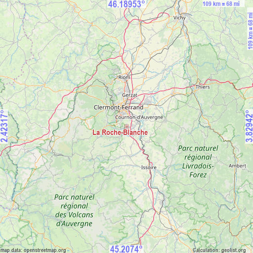
La Roche-Blanche GPS coordinates[2]
45° 42' 2.232" North, 3° 7' 34.644" East
| Map corner | latitude | longitude |
|---|---|---|
| Upper-left | 46.18953°, | 2.42317° |
| Center: | 45.70062°, | 3.12629° |
| Lower-right: | 45.2074°, | 3.82942° |
| Map W x H: | 109.2×109.2 km | = 67.9×67.9mi |
| max Lat: | 51.07786° ⇑70.9% North |
| La Roche-Blanche: | 45.70062° |
| min Lat: | ⇓29.1% South 41.3874° |
| min Long | La Roche-Blanch | max Long |
| -5.08615° | 3.12629° | 9.52242° |
| W 59.6%⇐ | ⇒40.4% E |
Elevation
Elevation of La Roche-Blanche is 469 m = 1539 ft, and this is 275.3 m = 903 ft above average elevation for this country.
| Max E: |
2333 m = 7654 ft | 8.2% |
| La Roche-Blanche | 469 m 1539 ft | |
| Avg. | 193.7 m = 635 ft | |
Min E: |
-1 m = -3 ft | 91.8% |
See also: France elevation on elevation.city.
Geographical zone
La Roche-Blanche is located in North temperate zone (between Tropic of Cancer and the Arctic Circle). Distance of this North polar circle is 2319.7 km =1441.4 mi to North.| Distance of | km | miles | from La Roche-Blanche |
|---|---|---|---|
| North Pole | 4925.6 | 3060.6 | to North |
| Arctic Circle | 2319.7 | 1441.4 | to North |
| Tropic Cancer | 2475.5 | 1538.2 | to South |
| Equator | 5081.4 | 3157.4 | to South |


Nearby cities:
15 places around La Roche-Blanche: (largest is in red/bold)
• Aubière
5.7 km =3.5 mi,  347°
347°
• Beaumont
6.6 km =4.1 mi,  329°
329°
• Ceyrat
6.1 km =3.8 mi,  306°
306°
• Chanonat
2.7 km =1.7 mi,  251°
251°
• Corent
6.5 km =4 mi,  125°
125°
• Le Cendre
5.3 km =3.3 mi,  62°
62°
• Le Crest
1.6 km =1 mi,  176°
176°
• Orcet
3.3 km =2.1 mi,  84°
84°
• Pérignat-lès-Sarliève
4.1 km =2.5 mi,  14°
14°
• Romagnat
3.8 km =2.4 mi, 328°
• Saint-Amant-Tallende
3.8 km =2.4 mi,  202°
202°
• Saint-Sandoux
6.8 km =4.2 mi,  192°
192°
• Saint-Saturnin
5.3 km =3.3 mi,  210°
210°
• Tallende
3.4 km =2.1 mi, 182°
• Veyre-Monton
5 km =3.1 mi,  135°
135°
Sources, notices
• [Note1] Compared only with cities in France existing in our database
• [Src1] Map data: © OpenStreetMap contributors (CC-BY-SA)
• [Src2] Other city data from geonames.org with taken over terms of usage.
• [Src3] Geographical zone / Annual Mean Temperature by Robert A. Rohde @ Wikipedia
