Chanonat geodata
Chanonat (Auvergne-Rhône-Alpes) is a populated place; located in France in Europe/Paris (GMT+2) time zone. With population of 1,487 people, there are 6238 cities with bigger population in this country. Compared to other cities in France, 71% of cities are located further ↑North; 59.2% of cities are located further ←West and 93.6% of cities have lower elevation than Chanonat. Note1
Administrative division(s):
- Level 1: Auvergne-Rhône-Alpes
- Level 2: Département du Puy-de-Dôme
- Level 3: Arrondissement de Clermont-Ferrand
- Level 4: Chanonat


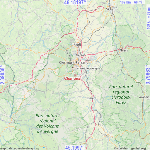
Chanonat GPS coordinates[2]
45° 41' 34.764" North, 3° 5' 36.636" East
| Map corner | latitude | longitude |
|---|---|---|
| Upper-left | 46.18197°, | 2.39038° |
| Center: | 45.69299°, | 3.09351° |
| Lower-right: | 45.1997°, | 3.79663° |
| Map W x H: | 109.2×109.2 km | = 67.9×67.9mi |
| max Lat: | 51.07786° ⇑71% North |
| Chanonat: | 45.69299° |
| min Lat: | ⇓29% South 41.3874° |
| min Long | Chanonat | max Long |
| -5.08615° | 3.09351° | 9.52242° |
| W 59.2%⇐ | ⇒40.8% E |
Elevation
Elevation of Chanonat is 527 m = 1729 ft, and this is 333.3 m = 1094 ft above average elevation for this country.
| Max E: |
2333 m = 7654 ft | 6.4% |
| Chanonat | 527 m 1729 ft | |
| Avg. | 193.7 m = 635 ft | |
Min E: |
-1 m = -3 ft | 93.6% |
See also: France elevation on elevation.city.
Geographical zone
Chanonat is located in North temperate zone (between Tropic of Cancer and the Arctic Circle). Distance of this North polar circle is 2320.6 km =1442 mi to North.| Distance of | km | miles | from Chanonat |
|---|---|---|---|
| North Pole | 4926.5 | 3061.2 | to North |
| Arctic Circle | 2320.6 | 1442 | to North |
| Tropic Cancer | 2474.7 | 1537.7 | to South |
| Equator | 5080.6 | 3156.9 | to South |


Nearby cities:
15 places around Chanonat: (largest is in red/bold)
• Aubière
6.6 km =4.1 mi,  11°
11°
• Beaumont
6.6 km =4.1 mi,  352°
352°
• Ceyrat
5 km =3.1 mi,  331°
331°
• La Roche-Blanche
2.7 km =1.7 mi,  71°
71°
• Le Cendre
8 km =5 mi, 65°
• Le Crest
2.7 km =1.7 mi,  104°
104°
• Orcet
6 km =3.7 mi,  78°
78°
• Pérignat-lès-Sarliève
6 km =3.7 mi,  36°
36°
• Romagnat
4.1 km =2.5 mi, 7°
• Saint-Amant-Tallende
2.9 km =1.8 mi,  157°
157°
• Saint-Genès-Champanelle
6.5 km =4 mi,  297°
297°
• Saint-Sandoux
5.9 km =3.7 mi,  169°
169°
• Saint-Saturnin
3.7 km =2.3 mi,  181°
181°
• Tallende
3.5 km =2.2 mi,  136°
136°
• Veyre-Monton
6.6 km =4.1 mi,  114°
114°
Sources, notices
• [Note1] Compared only with cities in France existing in our database
• [Src1] Map data: © OpenStreetMap contributors (CC-BY-SA)
• [Src2] Other city data from geonames.org with taken over terms of usage.
• [Src3] Geographical zone / Annual Mean Temperature by Robert A. Rohde @ Wikipedia
