Hénansal geodata
Hénansal (Brittany) is a populated place; located in France in Europe/Paris (GMT+2) time zone. With population of 975 people, there are 9023 cities with bigger population in this country. Compared to other cities in France, 69.3% of cities are located further ↓South; 96.1% of cities are located further →East and 67.8% of cities have higher elevation than Hénansal. Note1
Administrative division(s):
- Level 1: Brittany
- Level 2: Département des Côtes-d’Armor
- Level 3: Arrondissement de Saint-Brieuc
- Level 4: Hénansal


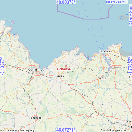
Hénansal GPS coordinates[2]
48° 32' 25.404" North, 2° 26' 1.104" West
| Map corner | latitude | longitude |
|---|---|---|
| Upper-left | 49.00378°, | -3.13677° |
| Center: | 48.54039°, | -2.43364° |
| Lower-right: | 48.07271°, | -1.73052° |
| Map W x H: | 103.5×103.5 km | = 64.3×64.3mi |
| max Lat: | 51.07786° ⇑30.7% North |
| Hénansal: | 48.54039° |
| min Lat: | ⇓69.3% South 41.3874° |
| min Long | Hénansal | max Long |
| -5.08615° | -2.43364° | 9.52242° |
| W 3.9%⇐ | ⇒96.1% E |
Elevation
Elevation of Hénansal is 83 m = 272 ft, and this is 110.7 m = 363 ft below average elevation for this country.
| Max E: |
2333 m = 7654 ft | 67.8% |
| Avg. | 193.7 m = 635 ft | |
| Hénansal | 83 m = 272 ft | |
Min E: |
-1 m = -3 ft | 32.2% |
See also: France elevation on elevation.city.
Geographical zone
Hénansal is located in North temperate zone (between Tropic of Cancer and the Arctic Circle). Distance of this North polar circle is 2004 km =1245.2 mi to North.| Distance of | km | miles | from Hénansal |
|---|---|---|---|
| North Pole | 4609.9 | 2864.5 | to North |
| Arctic Circle | 2004 | 1245.2 | to North |
| Tropic Cancer | 2791.3 | 1734.4 | to South |
| Equator | 5397.2 | 3353.7 | to South |


Nearby cities:
15 places around Hénansal: (largest is in red/bold)
• Andel
11.3 km =7 mi,  240°
240°
• Erquy
10.4 km =6.5 mi,  348°
348°
• Hénanbihen
4.8 km =3 mi,  61°
61°
• La Bouillie
3.7 km =2.3 mi,  358°
358°
• Lamballe
10 km =6.2 mi,  216°
216°
• Noyal
11.1 km =6.9 mi,  200°
200°
• Planguenoual
10.5 km =6.5 mi,  265°
265°
• Plurien
9.7 km =6 mi,  12°
12°
• Pléboulle
10.3 km =6.4 mi,  42°
42°
• Plédéliac
10.7 km =6.6 mi,  159°
159°
• Pléneuf-Val-André
10.2 km =6.3 mi,  305°
305°
• Pléven
10.2 km =6.3 mi,  123°
123°
• Ruca
7.6 km =4.7 mi,  67°
67°
• Saint-Alban
8 km =5 mi,  282°
282°
• Saint-Pôtan
11.1 km =6.9 mi,  84°
84°
Sources, notices
• [Note1] Compared only with cities in France existing in our database
• [Src1] Map data: © OpenStreetMap contributors (CC-BY-SA)
• [Src2] Other city data from geonames.org with taken over terms of usage.
• [Src3] Geographical zone / Annual Mean Temperature by Robert A. Rohde @ Wikipedia
