Saint-Porchaire geodata
Saint-Porchaire (Nouvelle-Aquitaine) is a populated place; located in France in Europe/Paris (GMT+2) time zone. With population of 1,437 people, there are 6447 cities with bigger population in this country. Compared to other cities in France, 69% of cities are located further ↑North; 86.3% of cities are located further →East and 94.4% of cities have higher elevation than Saint-Porchaire. Note1
Administrative division(s):
- Level 1: Nouvelle-Aquitaine
- Level 2: Charente-Maritime
- Level 3: Arrondissement de Saintes
- Level 4: Saint-Porchaire


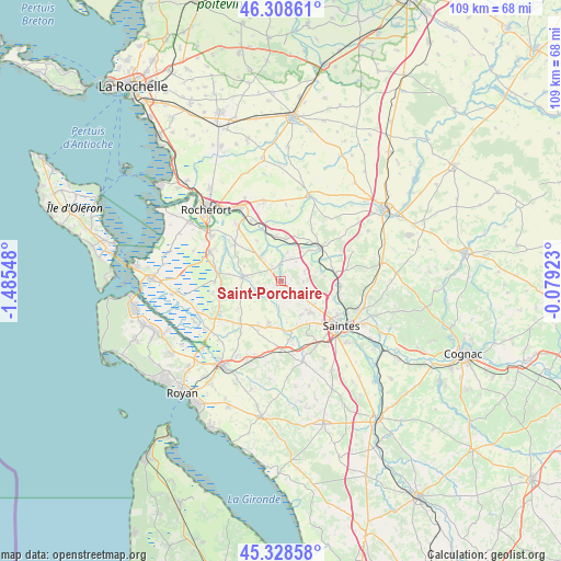
Saint-Porchaire GPS coordinates[2]
45° 49' 14.7" North, 0° 46' 56.46" West
| Map corner | latitude | longitude |
|---|---|---|
| Upper-left | 46.30861°, | -1.48548° |
| Center: | 45.82075°, | -0.78235° |
| Lower-right: | 45.32858°, | -0.07923° |
| Map W x H: | 109×109 km | = 67.7×67.7mi |
| max Lat: | 51.07786° ⇑69% North |
| Saint-Porchaire: | 45.82075° |
| min Lat: | ⇓31% South 41.3874° |
| min Long | Saint-Porchaire | max Long |
| -5.08615° | -0.78235° | 9.52242° |
| W 13.7%⇐ | ⇒86.3% E |
Elevation
Elevation of Saint-Porchaire is 19 m = 62 ft, and this is 174.7 m = 573 ft below average elevation for this country.
| Max E: |
2333 m = 7654 ft | 94.4% |
| Avg. | 193.7 m = 635 ft | |
| Saint-Porchaire | 19 m = 62 ft | |
Min E: |
-1 m = -3 ft | 5.6% |
See also: France elevation on elevation.city.
Geographical zone
Saint-Porchaire is located in North temperate zone (between Tropic of Cancer and the Arctic Circle). Distance of this North polar circle is 2306.4 km =1433.1 mi to North.| Distance of | km | miles | from Saint-Porchaire |
|---|---|---|---|
| North Pole | 4912.3 | 3052.4 | to North |
| Arctic Circle | 2306.4 | 1433.1 | to North |
| Tropic Cancer | 2488.9 | 1546.5 | to South |
| Equator | 5094.8 | 3165.8 | to South |


Nearby cities:
15 places around Saint-Porchaire: (largest is in red/bold)
• Beurlay
6.1 km =3.8 mi,  316°
316°
• Bords
8.6 km =5.3 mi,  353°
353°
• Champagne
9.8 km =6.1 mi,  277°
277°
• Corme-Royal
8.9 km =5.5 mi,  196°
196°
• Geay
5.8 km =3.6 mi,  13°
13°
• La Vallée
9 km =5.6 mi,  330°
330°
• Les Essards
3.7 km =2.3 mi,  150°
150°
• Nieul-lès-Saintes
7.8 km =4.8 mi, 149°
• Plassay
4.4 km =2.7 mi,  93°
93°
• Pont-l’Abbé-d’Arnoult
7.2 km =4.5 mi, 277°
• Romegoux
6 km =3.7 mi,  342°
342°
• Saint-Georges-des-Coteaux
7.9 km =4.9 mi,  139°
139°
• Saint-Savinien
10.2 km =6.3 mi,  51°
51°
• Sainte-Gemme
9.9 km =6.2 mi,  236°
236°
• Soulignonne
4.8 km =3 mi,  183°
183°
Sources, notices
• [Note1] Compared only with cities in France existing in our database
• [Src1] Map data: © OpenStreetMap contributors (CC-BY-SA)
• [Src2] Other city data from geonames.org with taken over terms of usage.
• [Src3] Geographical zone / Annual Mean Temperature by Robert A. Rohde @ Wikipedia
