Champagne geodata
Champagne (Nouvelle-Aquitaine) is a populated place; located in France in Europe/Paris (GMT+2) time zone. With population of 576 people, there are 13727 cities with bigger population in this country. Compared to other cities in France, 68.8% of cities are located further ↑North; 87.4% of cities are located further →East and 95.7% of cities have higher elevation than Champagne. Note1
Administrative division(s):
- Level 1: Nouvelle-Aquitaine
- Level 2: Charente-Maritime
- Level 3: Arrondissement de Rochefort
- Level 4: Champagne


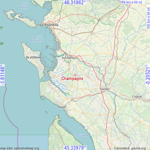
Champagne GPS coordinates[2]
45° 49' 54.696" North, 0° 54' 29.988" West
| Map corner | latitude | longitude |
|---|---|---|
| Upper-left | 46.31962°, | -1.61146° |
| Center: | 45.83186°, | -0.90833° |
| Lower-right: | 45.33979°, | -0.20521° |
| Map W x H: | 108.9×108.9 km | = 67.7×67.7mi |
| max Lat: | 51.07786° ⇑68.8% North |
| Champagne: | 45.83186° |
| min Lat: | ⇓31.2% South 41.3874° |
| min Long | Champagne | max Long |
| -5.08615° | -0.90833° | 9.52242° |
| W 12.6%⇐ | ⇒87.4% E |
Elevation
Elevation of Champagne is 15 m = 49 ft, and this is 178.7 m = 586 ft below average elevation for this country.
| Max E: |
2333 m = 7654 ft | 95.7% |
| Avg. | 193.7 m = 635 ft | |
| Champagne | 15 m = 49 ft | |
Min E: |
-1 m = -3 ft | 4.3% |
See also: France elevation on elevation.city.
Geographical zone
Champagne is located in North temperate zone (between Tropic of Cancer and the Arctic Circle). Distance of this North polar circle is 2305.1 km =1432.3 mi to North.| Distance of | km | miles | from Champagne |
|---|---|---|---|
| North Pole | 4911 | 3051.6 | to North |
| Arctic Circle | 2305.1 | 1432.3 | to North |
| Tropic Cancer | 2490.1 | 1547.3 | to South |
| Equator | 5096 | 3166.5 | to South |


Nearby cities:
15 places around Champagne: (largest is in red/bold)
• Beurlay
6.4 km =4 mi,  60°
60°
• Bords
11.4 km =7.1 mi,  50°
50°
• Cabariot
11.2 km =7 mi,  20°
20°
• La Gripperie-Saint-Symphorien
4 km =2.5 mi,  208°
208°
• La Vallée
8.4 km =5.2 mi,  38°
38°
• Pont-l’Abbé-d’Arnoult
2.6 km =1.6 mi,  97°
97°
• Romegoux
9.2 km =5.7 mi, 60°
• Saint-Agnant
6.2 km =3.9 mi,  318°
318°
• Saint-Hippolyte
9.8 km =6.1 mi,  7°
7°
• Saint-Just-Luzac
10.3 km =6.4 mi,  249°
249°
• Saint-Porchaire
9.8 km =6.1 mi, 97°
• Sainte-Gemme
6.8 km =4.2 mi,  167°
167°
• Soulignonne
11.2 km =7 mi,  122°
122°
• Trizay
5.7 km =3.5 mi, 8°
• Échillais
8.4 km =5.2 mi,  336°
336°
Sources, notices
• [Note1] Compared only with cities in France existing in our database
• [Src1] Map data: © OpenStreetMap contributors (CC-BY-SA)
• [Src2] Other city data from geonames.org with taken over terms of usage.
• [Src3] Geographical zone / Annual Mean Temperature by Robert A. Rohde @ Wikipedia
